Select Item below to DOWNLOAD - Once item is selected, right click and choose 'save as'
d0dbb0c47cef4a04a7edf5ddcd5684f6
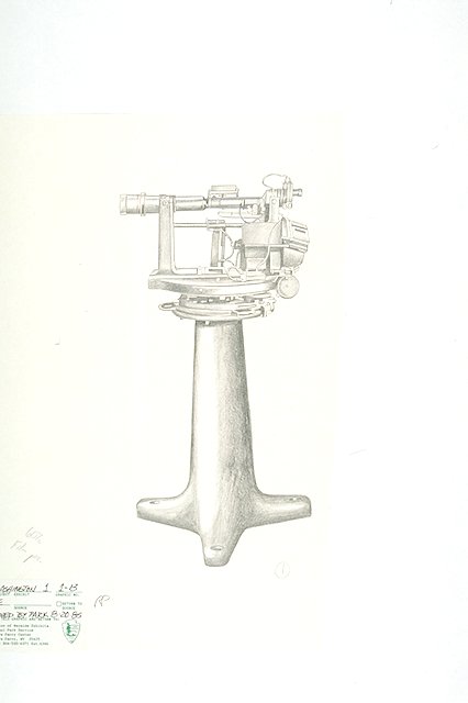
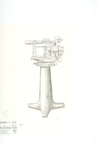
A depression position finder used to locate targets at ranges of between 1,500 and 12,000 yards
A depression position finder used to locate targets at ranges of between 1,500 and 12,000 yards
A depression position finder (PDF) is an observation instrument that was used in the fire control system of the United States Coast Artillery to locate targets in range and/or azimuth as part of the process of directing the fire of a battery of coast defense guns or mortars.
Abbr=WE
U.S. National Park Service
Reflective Art
Government owns art and all reproduction rights.
Public domain
Image
Fort Washington Park, Code: FOWA
Fort Washington Park, Prince George's County, Maryland
Latitude: 38.7122001647949, Longitude: -77.0287017822266
Latitude: 38.7122001647949, Longitude: -77.0287017822266
Image Management System : IMS 05305
20190904
01/01/1985 - 12/30/1985
Image_Size=6" x 7"; Exhibit 1/Graphic # 1-13
O 4
Public Can View
Organization: Harpers Ferry Center
Address: Harpers Ferry Center, 67 Mather Place, Harpers Ferry, WV, 25425, 304-535-5050
Address: Harpers Ferry Center, 67 Mather Place, Harpers Ferry, WV, 25425, 304-535-5050
Monday, October 7, 2019 2:51:18 PM
Monday, October 7, 2019 2:51:18 PM
05305.JPG
jpg
18.3 kB
Museum