Select Item below to DOWNLOAD - Once item is selected, right click and choose 'save as'
d0d131c5-e527-4578-95c8-ba8466c84382
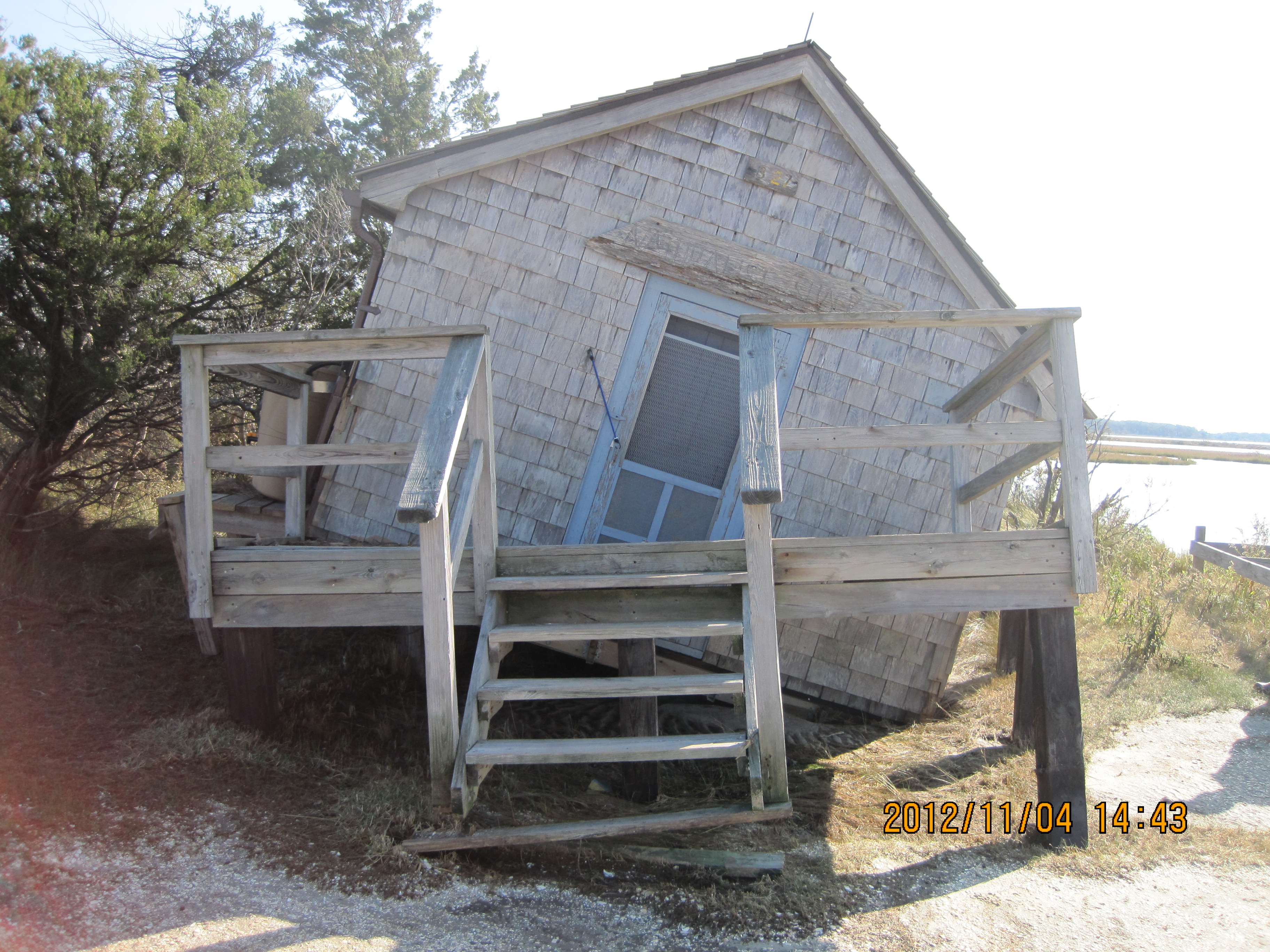
Assateague Naturalist Shack Damage from Hurricane Sandy
Damage to Naturalist Shack from Hurricane Sandy 10/30/2012
Permission must be secured from the individual copyright owners to reproduce any copyrighted materials contained within this website. Digital assets without any copyright restrictions are public domain.
All Rights Reserved
Storm damage, ()
Image
Assateague Island National Seashore, Code: ASIS
Assateague Island National Seashore
Latitude: 38.0390281677246, Longitude: -75.2496337890625
Latitude: 38.0390281677246, Longitude: -75.2496337890625
11/04/2012
10/30/2012
Public Can View
Thursday, November 8, 2012 11:17:09 AM
Thursday, August 10, 2017 9:43:50 AM
ASIS-c46e17b957c14fe084bece13166bb887.jpg
Canon Canon, Canon PowerShot SD1200 IS
1/640 sec at f / 2.8
6.2 mm
ISO 160
Sunday, November 4, 2012 9:43:45 PM
jpg
3.0 MB
Monitoring
,
Budget