Select Item below to DOWNLOAD - Once item is selected, right click and choose 'save as'
cb498649-f32a-4ed2-88fd-ea52fa6ec977
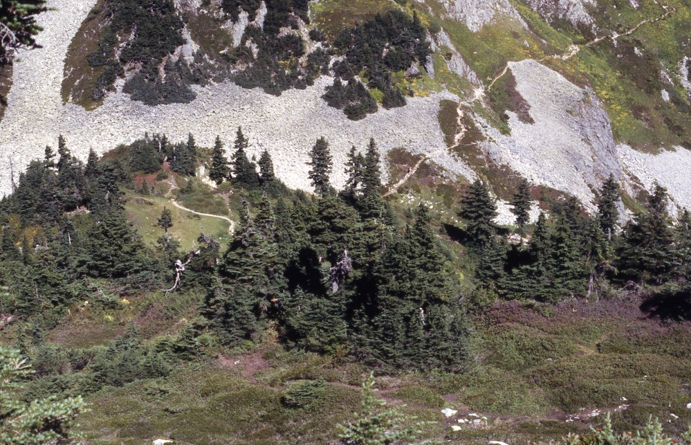
View of Cascade Pass and Sahale Trail from Mixup Arm, September 2002
A landscape view of gentle grassy hills with shrubs, wildflowers, and trees and rocky mountain slopes cut through by a trail. At the bottom is a pit of stones which is cut through by a trail.
Cascade Pass, Patio, revegetation monitoring photograph. Text on slide frame reads: "REV/CAS/PAT/a-22, 9-2002." (North Cascades NPS Complex Museum Collection, NOCA.0013 Revegetation Program Records, Series XI: Photographs, File 001 - Cascade Pass, Vicinity Impacts and Revegetation Sites, 1970-2004)
U.S. National Park Service
This digital asset is in the public domain. When using this asset for any purpose, including online, credit: 'Courtesy of North Cascades NPS Complex Museum Collection, Revegetation Program Records.'
NPS Photo
Public domain
Native Plant Restoration, (North Cascades Program)
, Cascade Pass, (North Cascades Locality)
, Revegetation, (North Cascades Activity)
, Cascade Pass, (North Cascades Locality)
, Revegetation, (North Cascades Activity)
Image
North Cascades National Park, Code: NOCA
North Cascades National Park, Washington
Latitude: 48.8278884887695, Longitude: -121.35050201416
Cascade Pass
Latitude: 48.8278884887695, Longitude: -121.35050201416
Cascade Pass
ICMS Archives Module : NOCA.0013.11.001
2024/01/29
09/01/2002 - 09/29/2002
slide transparency
Curation Facility
Public Can View
Person: NOCA Curator
Organization: North Cascades NPS Complex
Position: Museum Curator
Address: 7280 Ranger Station Road, Marblemount, WA 98267
Email: NOCA_Curator@nps.gov.
Organization: North Cascades NPS Complex
Position: Museum Curator
Address: 7280 Ranger Station Road, Marblemount, WA 98267
Email: NOCA_Curator@nps.gov.
Thursday, January 30, 2025 5:49:14 PM
Thursday, January 30, 2025 5:49:14 PM
0013.11.001.0138.tif
tif
37.0 MB
Monitoring