Select Item below to DOWNLOAD - Once item is selected, right click and choose 'save as'
c6f451bf-3397-4998-bad1-e304bc48b0bd
DEWA TTX-51 DEWA 00004116 gif
DEWA TTX-51 DEWA 00004116 gif
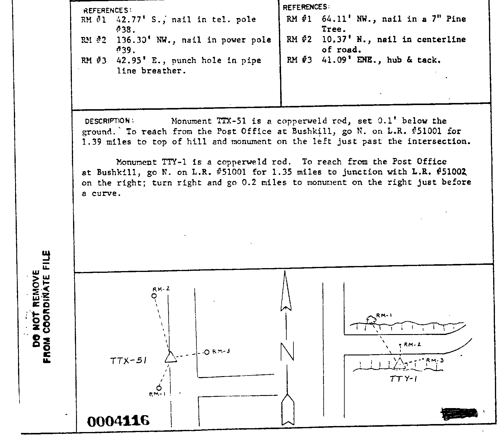
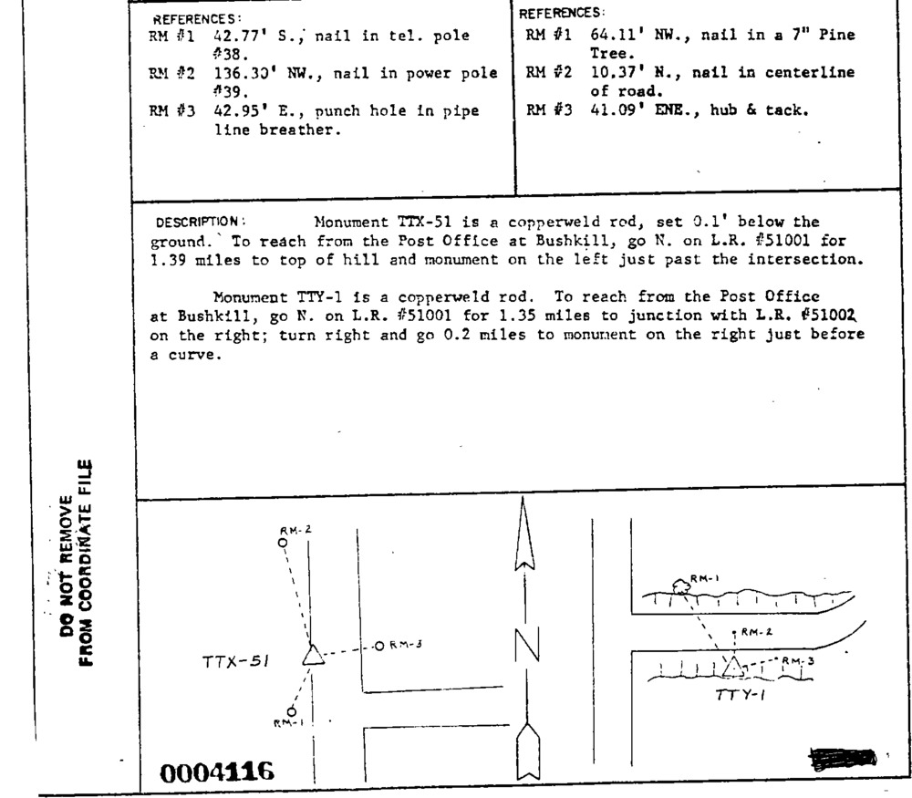
Survey monument record sheet, Sketch number: 00004116
U. S. National Park Service
This digital asset is in the public domain. When using this asset for any purpose, including online, credit: 'U.S. National Park Service, Land Resources Division'.
Public domain
Image
Delaware Water Gap National Recreation Area, Code: DEWA
Delaware Water Gap National Recreation Area
Latitude: 41.1003189086914, Longitude: -74.9569320678711
Latitude: 41.1003189086914, Longitude: -74.9569320678711
MONUMENTID for Monuments : DEWA TTX-51
2024/11/15
01/01/1967
NGS
Public Can View
Organization: Land Resources Division
Position: Program Coordinator
Address: 1849 C Street, NW, Suite 2340, Main Interior Building, Washington, DC 20240
Position: Program Coordinator
Address: 1849 C Street, NW, Suite 2340, Main Interior Building, Washington, DC 20240
Thursday, December 5, 2024 6:27:17 PM
Thursday, December 5, 2024 6:27:17 PM
DEWA_00004116.gif
gif
44.0 kB
Monitoring
,
Inventory
,
Map