Select Item below to DOWNLOAD - Once item is selected, right click and choose 'save as'
c674b373563e45afad3d13488861a15f
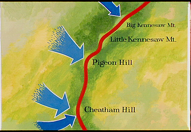
Map showing precise Union strike areas (blue arrows) along Kennesaw Mountain, Little Kennesaw Mountain, Pigeon Hill, and Cheatham Hill.
Map showing precise Union strike areas (blue arrows) along Kennesaw Mountain, Little Kennesaw Mountain, Pigeon Hill, and Cheatham Hill.
Abbr=AVA
U.S. National Park Service
Reflective Art
Government owns art and all reproduction rights.
Public domain
Image
Kennesaw Mountain National Battlefield Park, Code: KEMO
Kennesaw Mountain National Battlefield Park, Cobb County, Georgia
Latitude: 33.9772987365723, Longitude: -84.5789031982422
Latitude: 33.9772987365723, Longitude: -84.5789031982422
Image Management System : IMS 01737
20190904
01/01/1977 - 12/30/1977
Image_Size=W: 12" x H: 8"; Metric_Size=W: 30.46CM X H: 20.30CM; AVA Project #38, Plate 41
C11
Public Can View
Organization: Harpers Ferry Center
Address: Harpers Ferry Center, 67 Mather Place, Harpers Ferry, WV, 25425, 304-535-5050
Address: Harpers Ferry Center, 67 Mather Place, Harpers Ferry, WV, 25425, 304-535-5050
Monday, October 7, 2019 3:04:10 PM
Monday, October 7, 2019 3:04:10 PM
01737.JPG
jpg
84.0 kB
Museum