Select Item below to DOWNLOAD - Once item is selected, right click and choose 'save as'
c5a9a5f6-aa68-475b-983f-c57014828227
VAMA Brochure Orientation Map.jpg
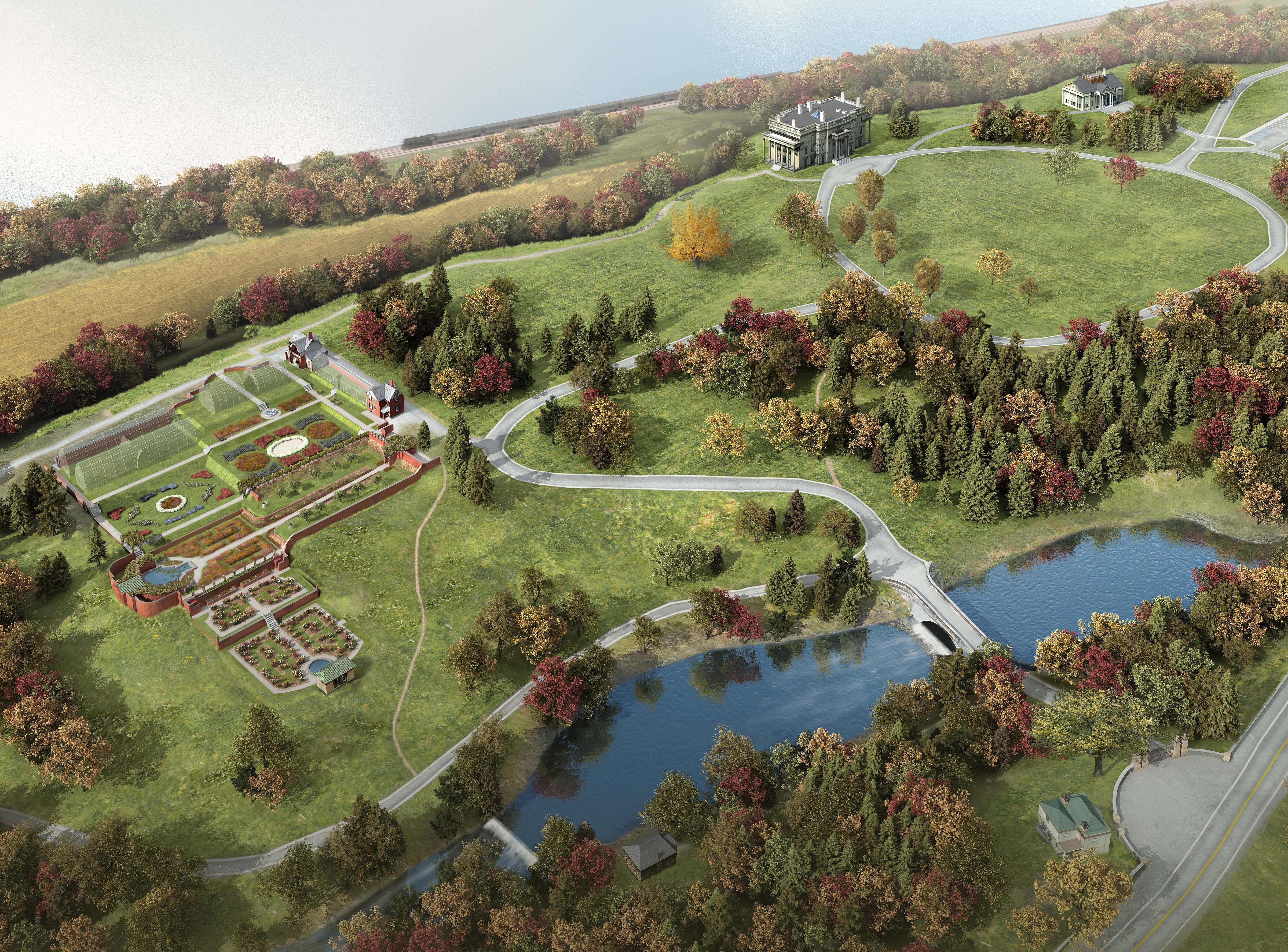
An artist's rendering of the park, nestled between the Hudson River and Route 9. Roadways, paths, a pond, buildings, and gardens are among mowed lawns. An accessible version of the brochure is available on the park website.
Side two of the park brochure.
Permission must be secured from the individual copyright owners to reproduce any copyrighted materials contained within this website. Digital assets without any copyright restrictions are public domain.
National Park Service, Vanderbilt Mansion National Historic Site.
Public domain:Full Granting Rights
Image
Vanderbilt Mansion National Historic Site, Code: VAMA
Vanderbilt Mansion National Historic Site, Dutchess County, New York
Latitude: 41.7943992614746, Longitude: -73.9419021606445
Latitude: 41.7943992614746, Longitude: -73.9419021606445
07/14/2015
07/14/2015
Public Can View
Monday, February 26, 2024 6:04:46 PM
Monday, February 26, 2024 6:35:52 PM
VAMA Brochure Orientation Map.jpg
Tuesday, July 14, 2015 2:04:37 PM
jpg
3.3 MB
Scenic