Select Item below to DOWNLOAD - Once item is selected, right click and choose 'save as'
c24704b8-c01e-4633-8000-01acac7e6211
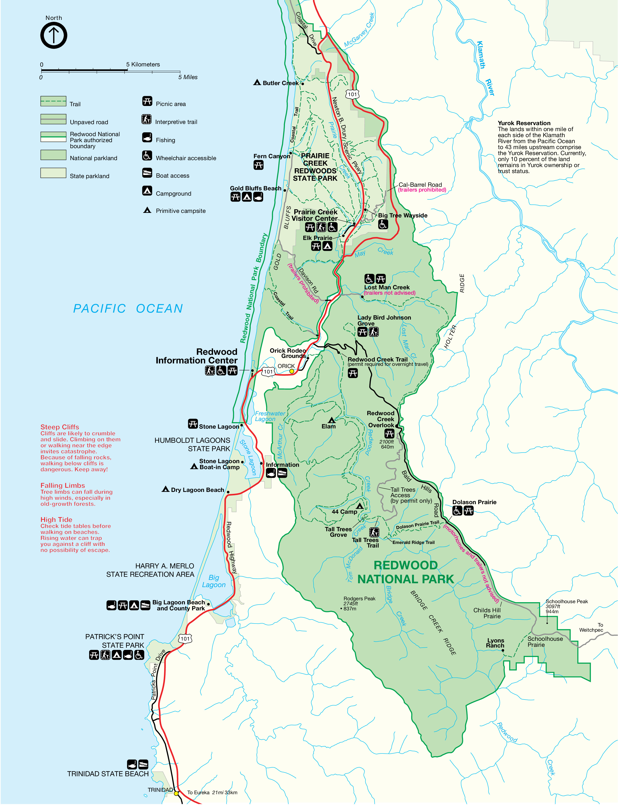
Redwood National and State Parks - South Detail Map - Redwood National and State Parks
Detail map of Redwood National Park in California. This section of the park is a shallow boomerang shape shaded light green sitting along the sky-blue Pacific Ocean, surrounded by white lands to the east. US Highway 101 is cherry red, snaking north-south through the park and down the coast.
Screen-viewable file; Adobe print production files can be downloaded from the Compressed zip Version link
Map Projection: Other; Map Type: unassigned
U.S. National Park Service
The National Park Service maps are government produced and are in the public domain. Anyone may, without restriction under U.S. copyright laws: Reproduce the work in print or digital form; Create derivative works; Perform the work publicly; Display the work; Distribute copies or digitally transfer the work to the public by sale or other transfer of ownership, or by rental, lease, or lending. Please note, a user who modifies and/or republishes National Park Service maps are responsible for any problems encountered with the maps, due to their change or modification.
Public domain
Document
Redwood National and State Parks, Code: REDW
Redwood National and State Parks, California
Latitude: 41.2768592834473, Longitude: -124.00479888916
Latitude: 41.2768592834473, Longitude: -124.00479888916
2013-05-07
Public Can View
Person: Harpers Ferry Center
Organization: US National Park Service
Address: Harpers Ferry Center, Harpers Ferry, WV
Email: HFC_Cartography@nps.gov
Organization: US National Park Service
Address: Harpers Ferry Center, Harpers Ferry, WV
Email: HFC_Cartography@nps.gov
Monday, May 2, 2022 9:39:39 PM
Friday, September 26, 2025 11:37:13 PM
REDWmap6.pdf
pdf
171.0 kB
Map