Select Item below to DOWNLOAD - Once item is selected, right click and choose 'save as'
bfe024f756074d0bb248e5aed8f2a4ae
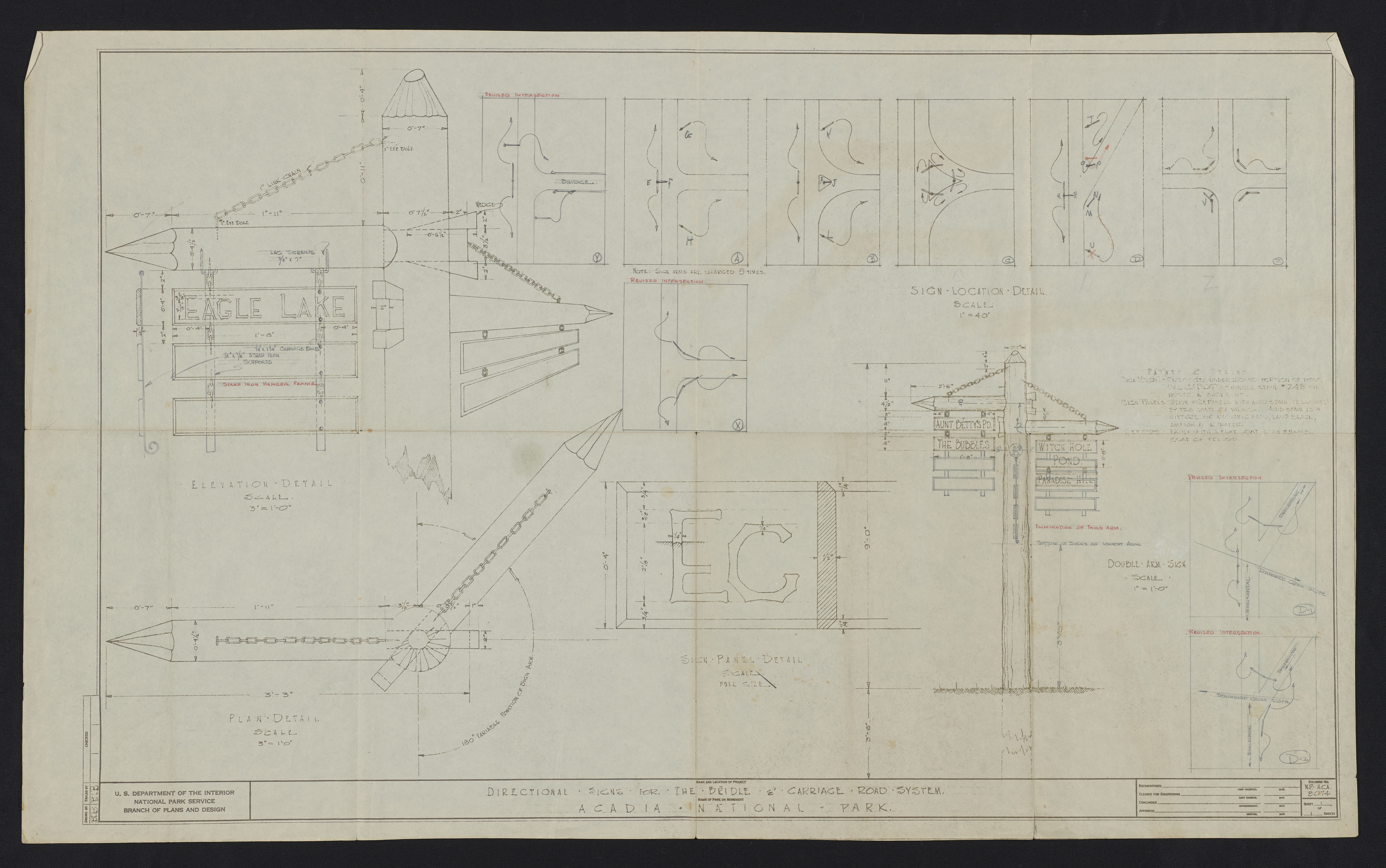
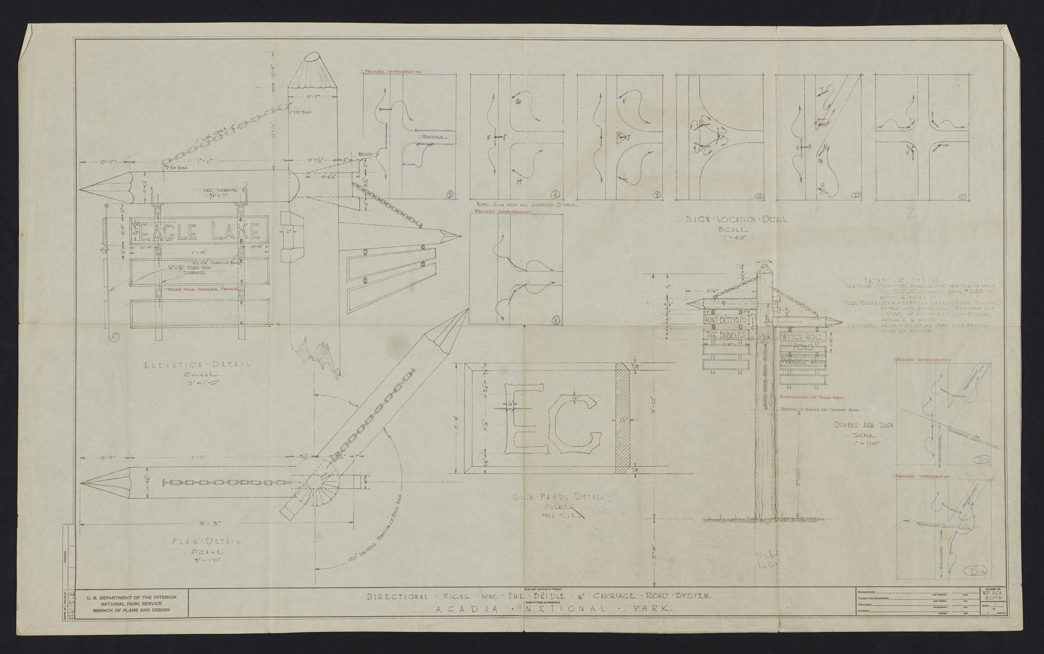
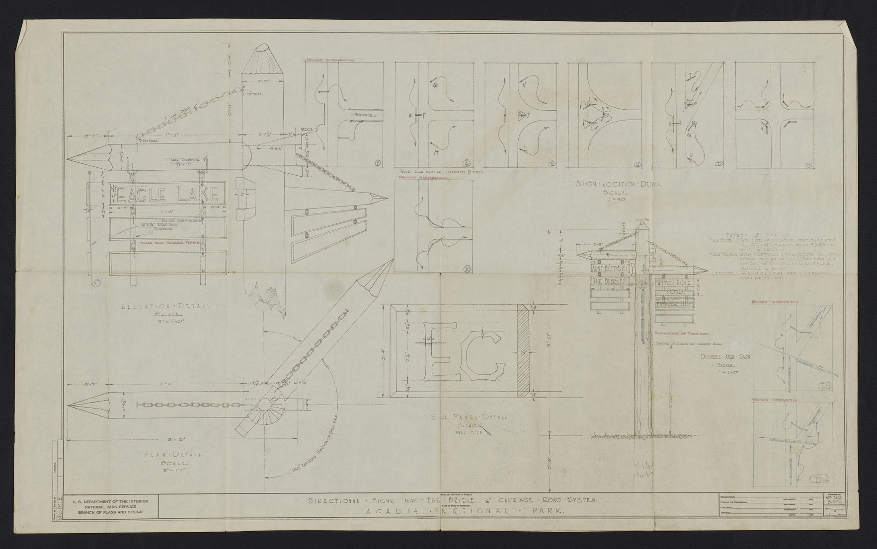
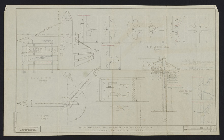
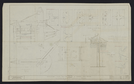
Directional Signs for the Bridle & Carriage Road System/ Acadia National Park
Detailed construction drawing for carriage road signs. Includes measurements, dimensions as well as notes on paints, stains, and materials. Drawing created by U.S. Department of the Interior National Park Service Branch of Plans and Design. Plan drawn by BLB and traced by BLB. ; Drawing No. N.P. - ACA 8074
CollectionNbr: 4000 ; SeriesNbr: 012.002.001 ;
U. S. National Park Service
Caption: Notes on plan scales, paints, and stains.
Permission must be secured from the individual copyright owners to reproduce any copyrighted materials contained within this website.
Restrictions apply on use and/or reproduction
Image
Acadia National Park, Code: ACAD
Acadia National Park, Maine
Latitude: 44.3593788146973, Longitude: -68.2397308349609
Latitude: 44.3593788146973, Longitude: -68.2397308349609
After 1929
Paper ; Physical Characteristics: Good - Brown, blue, and red ink. Moderate creases and discoloration. ; Extent: 1 Each
HQ/R5/U2/S3, HQ/R7, HQ/R8
Public Can View
Person: Curator
Organization: US National Park Service
Address: Acadia National Park, Bar Harbor ME
Email: Acadia_Collections@nps.gov
Organization: US National Park Service
Address: Acadia National Park, Bar Harbor ME
Email: Acadia_Collections@nps.gov
Wednesday, October 17, 2018 8:07:17 AM
Wednesday, October 17, 2018 8:07:17 AM
Carriage Road Directional Signs.tif
tif
187.9 MB
Historic