Select Item below to DOWNLOAD - Once item is selected, right click and choose 'save as'
be9bd6dc-cead-4494-a846-e4c5d756be19
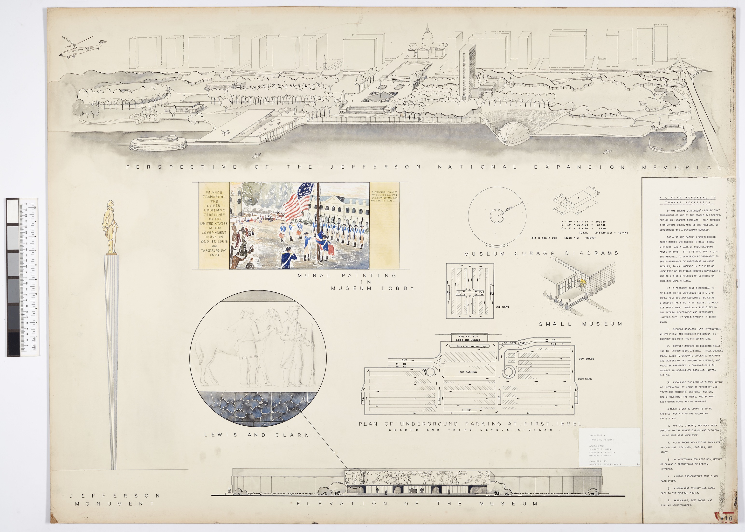
#016 Thomas K. Hendryx, Sheet B
Architectural elevation
#016 Thomas K. Hendryx, Sheet B
Permission must be secured from the individual copyright owners to reproduce any copyrighted materials contained within this website. Digital assets without any copyright restrictions are public domain.
Gateway Arch National Park Archives
Public domain:Full Granting Rights
Image
Gateway Arch National Park, Code: JEFF
Gateway Arch National Park
Latitude: 38.6234588623047, Longitude: -90.175407409668
Latitude: 38.6234588623047, Longitude: -90.175407409668
01/01/1947 | Scan created of 1947 architectural drawing in 2023
12/05/2022
Public Can View
Tuesday, October 31, 2023 5:13:50 PM
Tuesday, October 31, 2023 7:12:13 PM
016 B_Hendryx.tif
Canon Canon, Canon EOS 5DS R 100, Canon EF 50mm f/2.5 Compact Macro
1/125 sec at f / 11
50 mm
ISO 100
Monday, December 5, 2022 12:28:39 AM
tif
327.2 MB
Scenic