Select Item below to DOWNLOAD - Once item is selected, right click and choose 'save as'
be293fcb-c323-4aee-83af-ed7ce5c64355
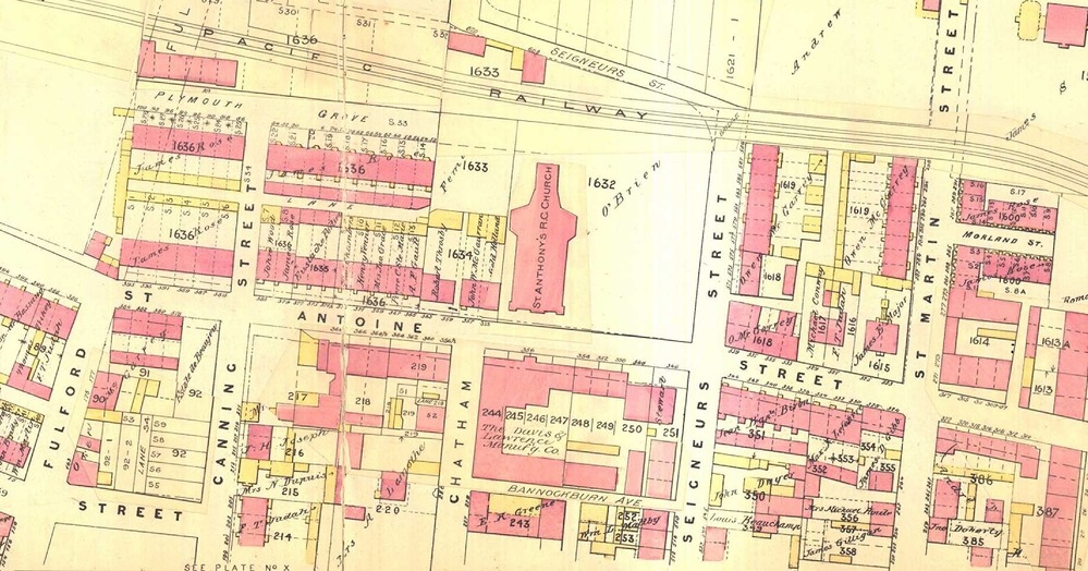
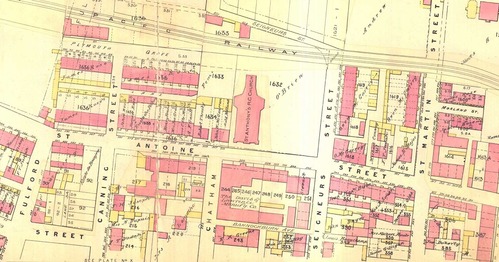
Map of St. Antoine Ward, that shows St. Antoine Street
Map of St. Antoine Ward, that shows St. Antoine Street
Map of St. Antoine Ward, that shows St. Antoine Street.
https://imtl.org/carte_historique.php?carte=252
Public domain
Image
Boston African American National Historic Site, Code: BOAF
Boston African American National Historic Site, Suffolk County, Massachusetts
Latitude: 42.3578987121582, Longitude: -71.0706024169922
Latitude: 42.3578987121582, Longitude: -71.0706024169922
01/01/1890
01/01/0001
Public Can View
Thursday, September 3, 2020 1:48:21 PM
Thursday, September 3, 2020 1:48:21 PM
SFM12-St-Antoine.jpg
Monday, January 1, 0001 12:00:00 AM
jpg
730.6 kB
Map