Select Item below to DOWNLOAD - Once item is selected, right click and choose 'save as'
be167cf2-94e4-4d83-8398-5cf6c99e6369
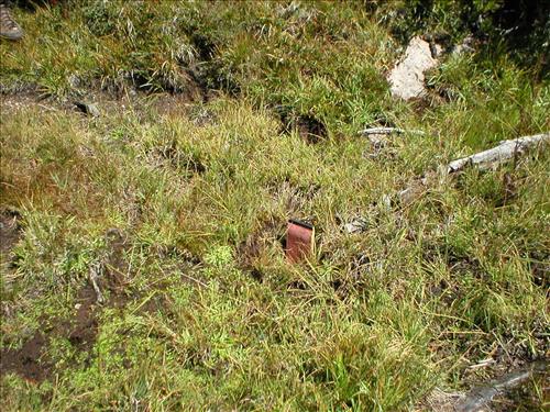
Hoof impacts and shearing at Upper Bubbs Meadow, Sequoia and Kings Canyon National Park
Between July and September 2003 the Stock Use and Meadow Monitoring Program at Sequoia and Kings Canyon National Parks conducted an environmental assessment of a number of wilderness meadows within the boundaries of the two parks. The image(s) included here are part of the digital image record created as part of those surveys.
U.S. National Park Service
Ranger Station: Charlotte || Zone and meadow: 65-4
Permission must be secured from the individual copyright owners to reproduce any copyrighted materials contained within this website. Digital assets without any copyright restrictions are public domain.
Public domain
Image
Sequoia and Kings Canyon National Parks, Code: SEKI
Upper Bubbs Meadow, Sequoia and Kings Canyon National Parks, California
Latitude: 36.7172584533691, Longitude: -118.537902832031

Legacy NPS Focus Record ID : 231551
09/05/2003 | 2003/09/05
09/05/2003
Public Can View
Gordon, D
Sequoia and Kings Canyon National Parks. Stock Use and Meadow Monitoring Program
Administrator
Wednesday, September 29, 2004 6:26:11 PM
Thursday, August 10, 2017 7:23:49 AM
mdw65-4_2003007.jpg
Monday, January 1, 0001 12:00:00 AM
jpg
575.9 kB
Scenic