Select Item below to DOWNLOAD - Once item is selected, right click and choose 'save as'
bc5283a6-b58a-4ef9-820a-2cc0a889f985
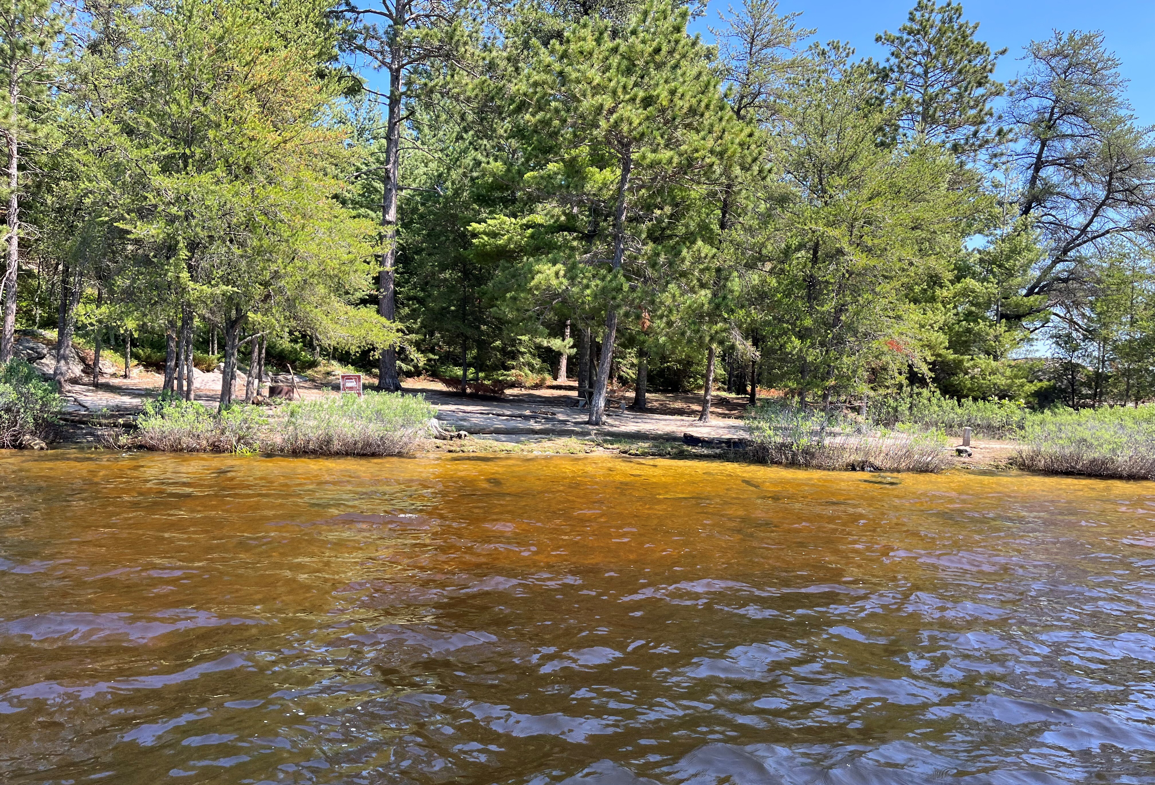
Houseboat Blueberry Island East at Rainy Lake, Sand mooring; Shore In
Houseboat Blueberry Island East at Rainy Lake, Sand mooring; Shore In
Voyageurs Houseboat
U. S. National Park Service
This digital asset is in the public domain. When using this asset for any purpose, including online, credit: 'Courtesy U.S. National Parks'
Public domain
R89, (Voyageurs Map Number)
, Blueberry Island East, (Voyageurs Site Name)
, Houseboat, (Voyageurs Site Type)
, Rainy Lake, (Voyageurs Location)
, Sand, (Voyageurs Mooring)
, Blueberry Island East, (Voyageurs Site Name)
, Houseboat, (Voyageurs Site Type)
, Rainy Lake, (Voyageurs Location)
, Sand, (Voyageurs Mooring)
Image
Voyageurs National Park, Code: VOYA
Rainy Lake
Blueberry Island East
Latitude: 48.545, Longitude: -92.814
Voyageurs National Park, Minnesota
Latitude: 48.48828125, Longitude: -92.8048095703125
Blueberry Island East
Latitude: 48.545, Longitude: -92.814
Voyageurs National Park, Minnesota
Latitude: 48.48828125, Longitude: -92.8048095703125
2022/08/18
Public Can View
Person: Program Manager
Organization: US National Park Service
Address: Voyageurs National Park Headquarters, 360 Hwy 11 East, International Falls , MN 56649
Organization: US National Park Service
Address: Voyageurs National Park Headquarters, 360 Hwy 11 East, International Falls , MN 56649
Tuesday, January 3, 2023 11:25:01 PM
Tuesday, January 3, 2023 11:25:01 PM
Shore In (3).JPG
jpg
5.1 MB
Inventory