Select Item below to DOWNLOAD - Once item is selected, right click and choose 'save as'
b62fb5cf-7784-4be6-ac42-3ad7e2455a9a
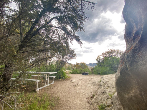
Campsite 47 picnic table and fire ring
Picnic table next to a mahogany tree with a fire ring in an open sandy area beyond.
hike-in 20 ft, rock, tent pad 10x10 ft, some shade, can accommodate RV 28 feet or less.
Permission must be secured from the individual copyright owners to reproduce any copyrighted materials contained within this website. Digital assets without any copyright restrictions are public domain.
Public domain:Full Granting Rights
Image
City of Rocks National Reserve, Code: CIRO
Latitude: 42.0770833333333, Longitude: -113.722327777778, Elevation: 1979.05859375
City of Rocks National Reserve, Cassia County, Idaho
Latitude: 42.0699005126953, Longitude: -113.71199798584
City of Rocks National Reserve, Cassia County, Idaho
Latitude: 42.0699005126953, Longitude: -113.71199798584
05/29/2020
05/29/2020
Public Can View
Wednesday, May 12, 2021 2:29:33 PM
Tuesday, June 17, 2025 5:20:32 PM
47b.jpg
Apple Apple, iPhone 11 Pro 64, iPhone 11 Pro back triple camera 1.54mm f/2.4
1/120 sec at f / 2.4
1.54 mm
ISO 64
Friday, May 29, 2020 10:05:04 PM
jpg
2.6 MB
Scenic