Select Item below to DOWNLOAD - Once item is selected, right click and choose 'save as'
b5f906a6-2ca6-402a-b862-8fa06cd68d50
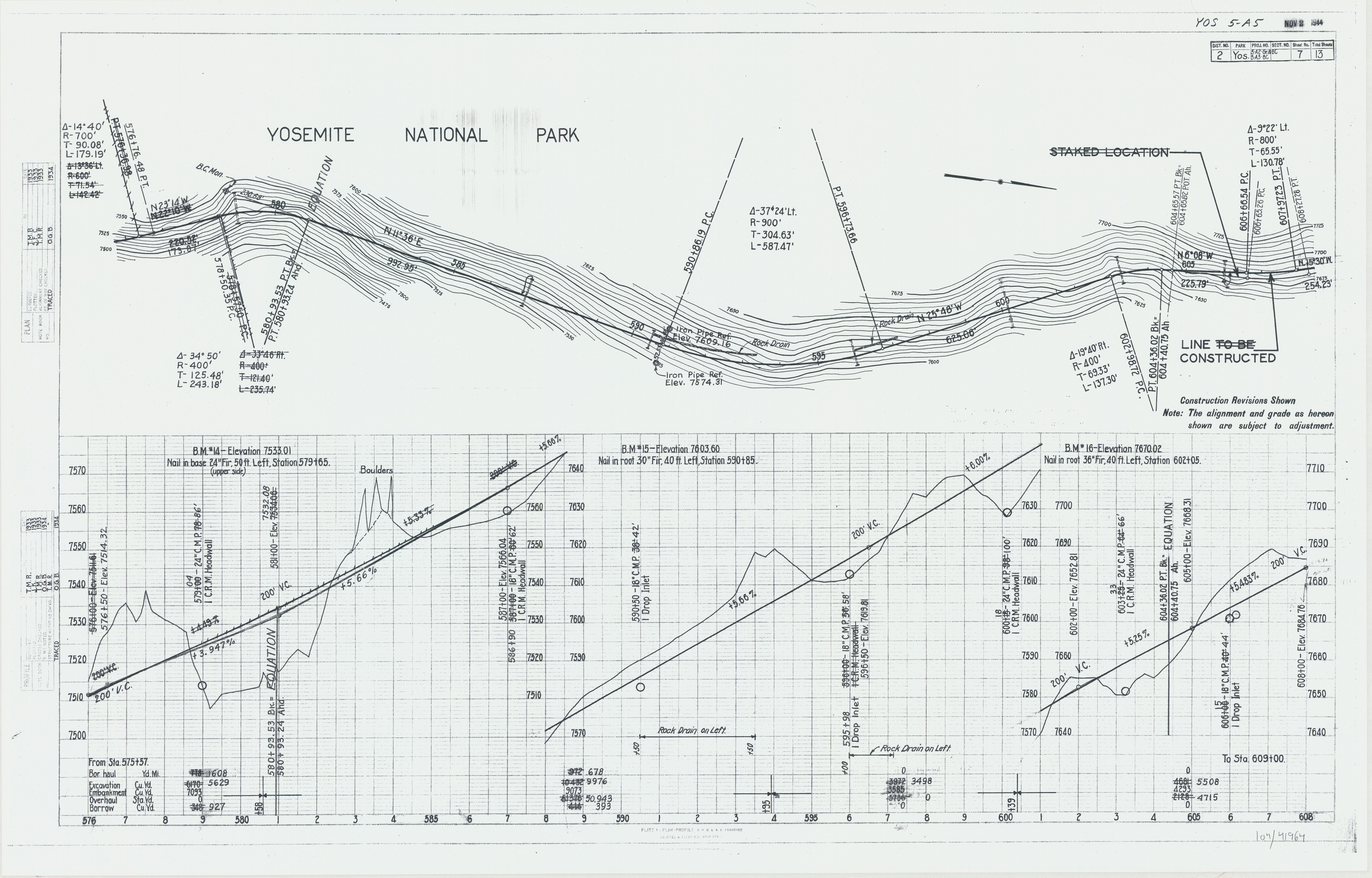
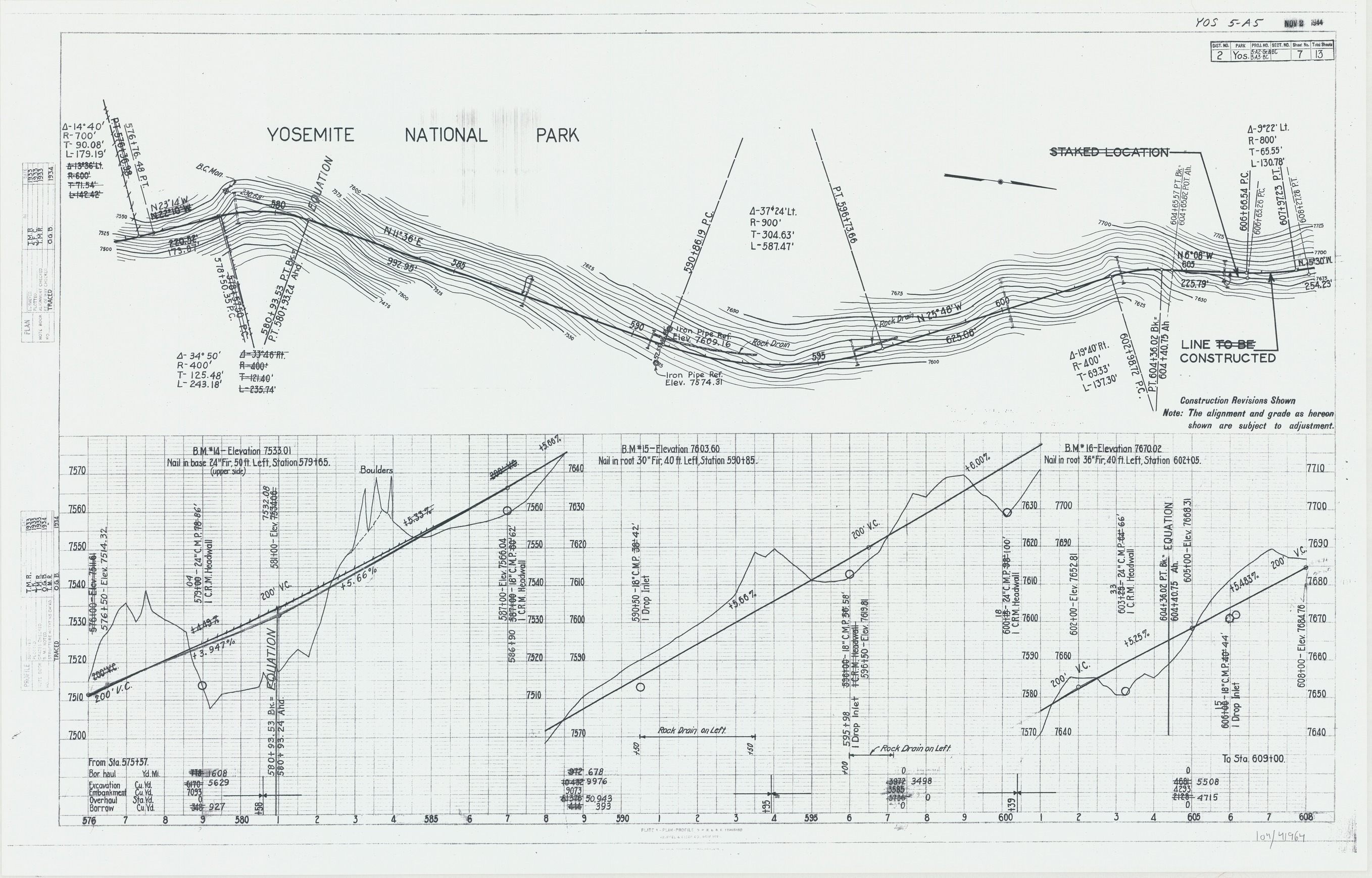
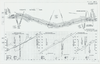
Plans for Propsed Route No. 5 - Wawona Road Glacier Point
Plans for Propsed Route No. 5 - Wawona Road Glacier Point
Plan and Profile Map for Wawona Road
Item Number: YOSEAR001994E, AlternateId: YOS 5-A5, 104-41964
Contact Yosemite National Park for more copyright information and use
Public domain:This digital asset is in the public domain. When using this asset for any purpose, including online, credit:'Courtesy U.S. National Parks'
104-41964, (YOSE TIC Number)
Image
Yosemite National Park, Code: YOSE
Yosemite National Park, California
Yosemite National Park, California
Latitude: 37.8399200439453, Longitude: -119.540397644043
Yosemite National Park, California
Latitude: 37.8399200439453, Longitude: -119.540397644043
1994
01/01/1994 - 12/30/1994
Type:diazotype paper, Dimensions: 24 x 36, Condition: good
YOSE Location: E4 DR13 (Wawona / Chinquapin 3-A-07-001)
Public Can View
Person: Archivist
Organization: US National Park Service
Address: Yosemite National Park Archives, PO Box 700-W, El Portal, CA 95318
Email: yose_archives@nps.gov
Organization: US National Park Service
Address: Yosemite National Park Archives, PO Box 700-W, El Portal, CA 95318
Email: yose_archives@nps.gov
Wednesday, August 2, 2023 7:43:11 PM
Wednesday, August 2, 2023 7:43:11 PM
YOSEAR001994E.tif
tif
907.9 MB
Historic
,
Map