Select Item below to DOWNLOAD - Once item is selected, right click and choose 'save as'
b222aaff-d667-41c6-b1a3-03f4a2ed3355
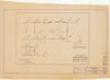
Big Meadows & "McCauley 40" Tracts
Big Meadows & "McCauley 40" Tracts
Record of Survey map of Big Meadow & McCauley 40" Tracts with coordinates and signatures
Item Number: YOSEAR001889, AlternateId: Sheet 1 of 1, NP YOS - 2287
Contact Yosemite National Park for more copyright information and use
Public domain:This digital asset is in the public domain. When using this asset for any purpose, including online, credit:'Courtesy U.S. National Parks'
NP YOS - 2287, (YOSE TIC Number)
Image
Yosemite National Park, Code: YOSE
Yosemite National Park, California
Yosemite National Park, California
Latitude: 37.8399200439453, Longitude: -119.540397644043
Yosemite National Park, California
Latitude: 37.8399200439453, Longitude: -119.540397644043
1964
01/01/1964 - 12/30/1964
Type:plastic overlay, Dimensions: 25 x 36, Condition: good
YOSE Location: E3 DR10 F24
Public Can View
Person: Archivist
Organization: US National Park Service
Address: Yosemite National Park Archives, PO Box 700-W, El Portal, CA 95318
Email: yose_archives@nps.gov
Organization: US National Park Service
Address: Yosemite National Park Archives, PO Box 700-W, El Portal, CA 95318
Email: yose_archives@nps.gov
Wednesday, August 2, 2023 10:29:22 PM
Wednesday, August 2, 2023 10:29:22 PM
YOSEAR001889.tif
tif
467.7 MB
Historic
,
Map