Select Item below to DOWNLOAD - Once item is selected, right click and choose 'save as'
b0f85cb8-6cac-4816-baac-741a4bf80b2c
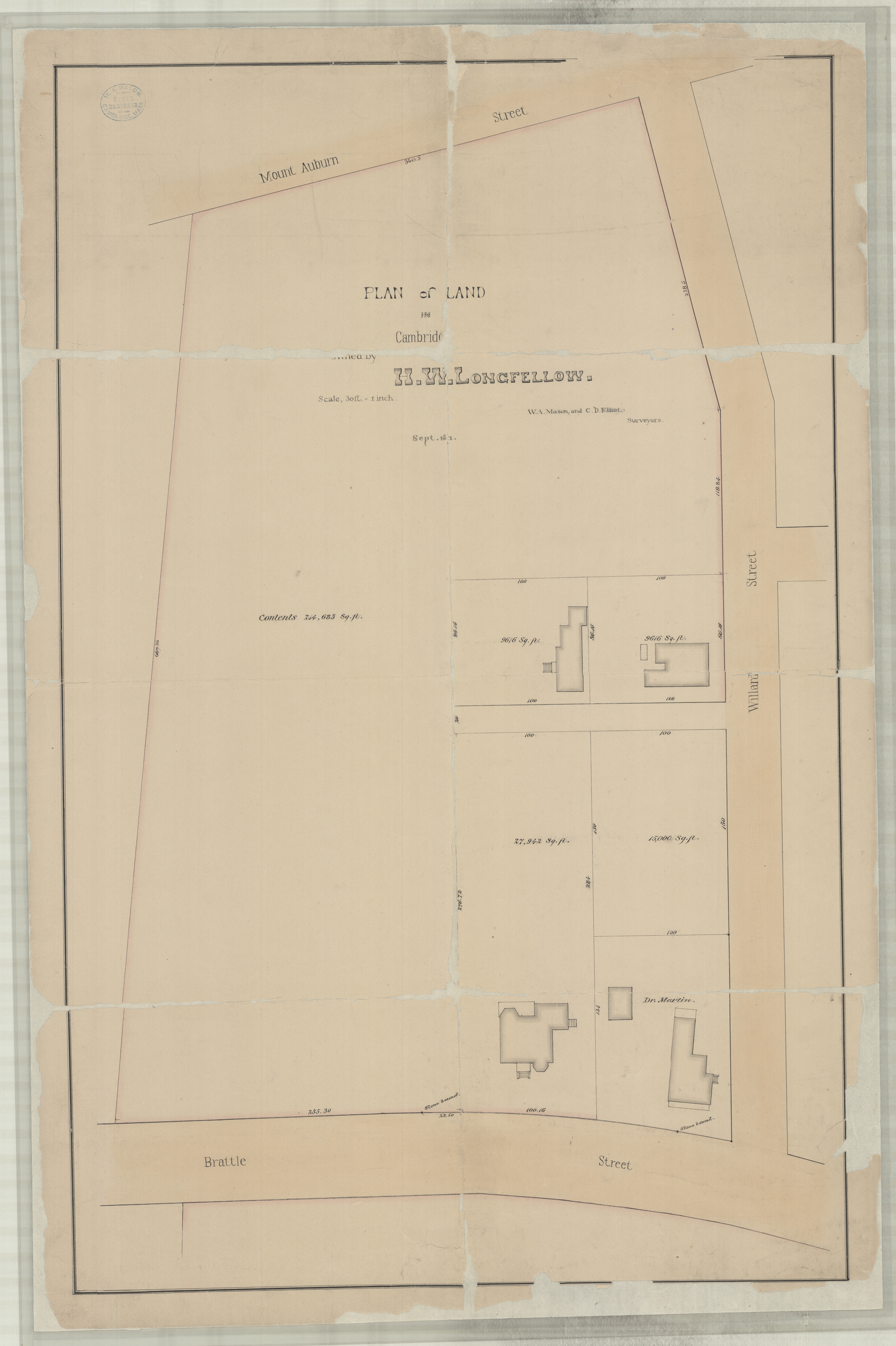
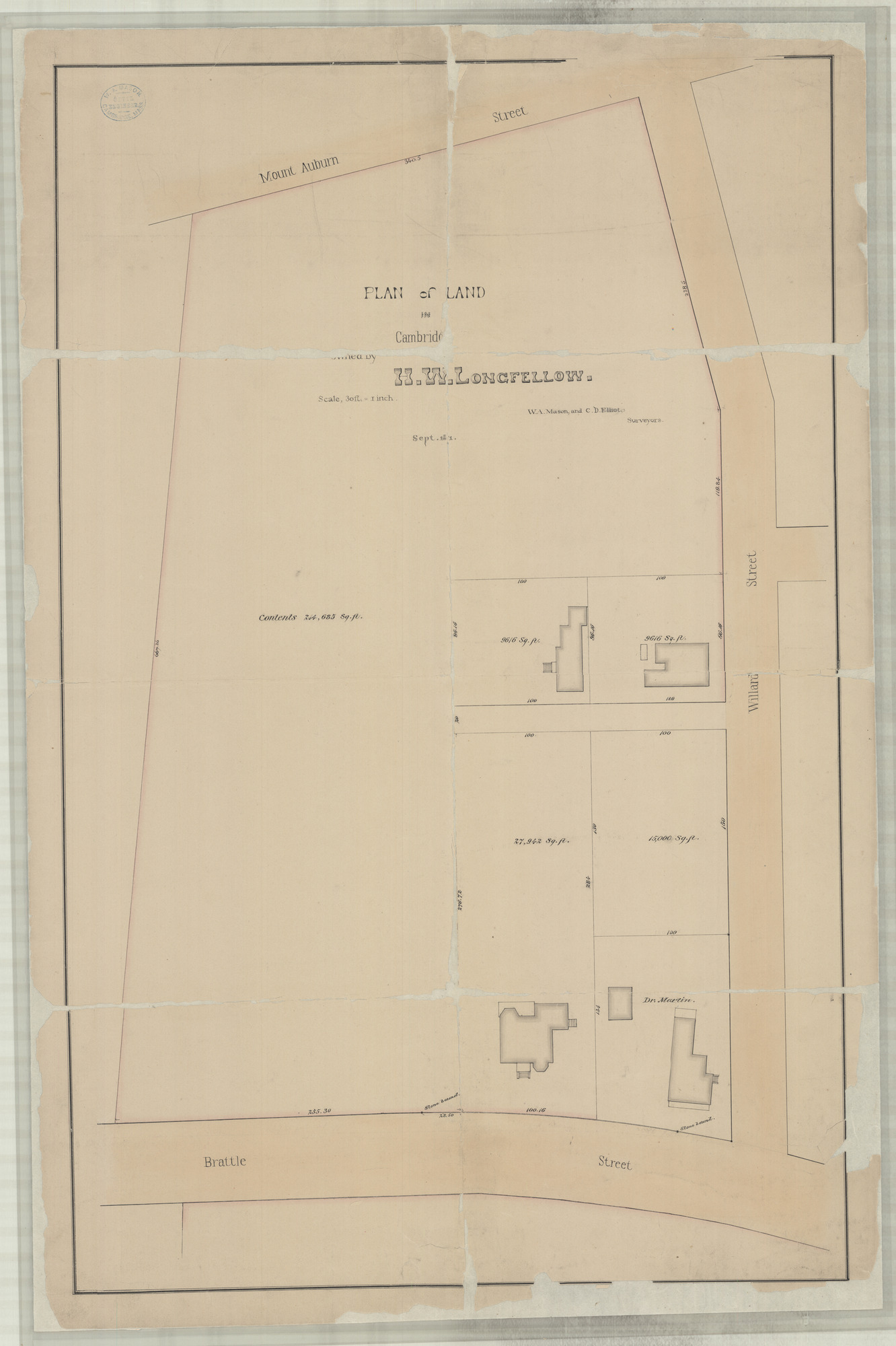
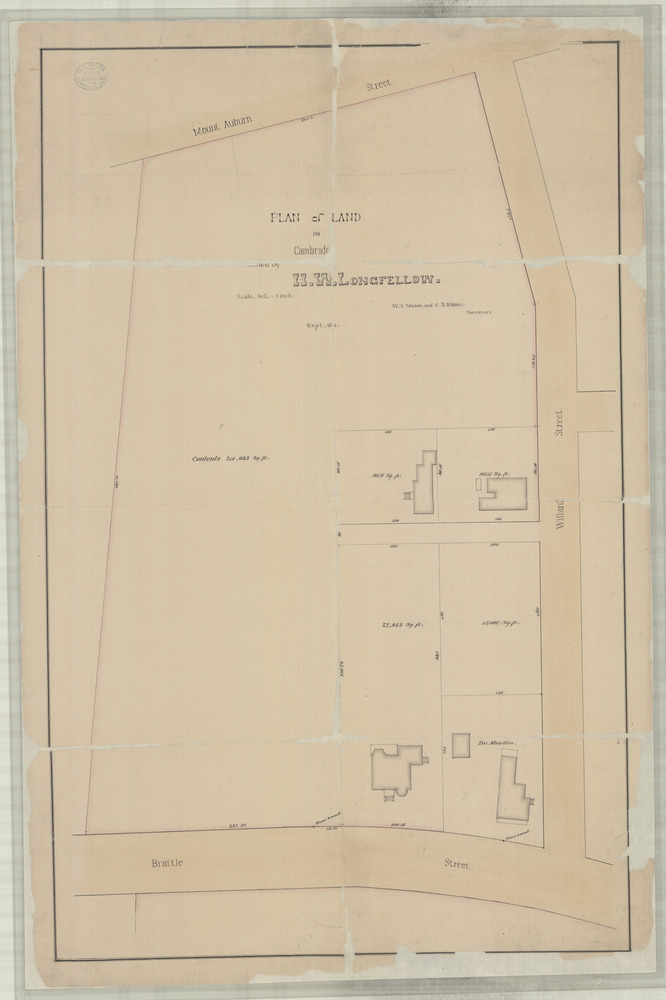
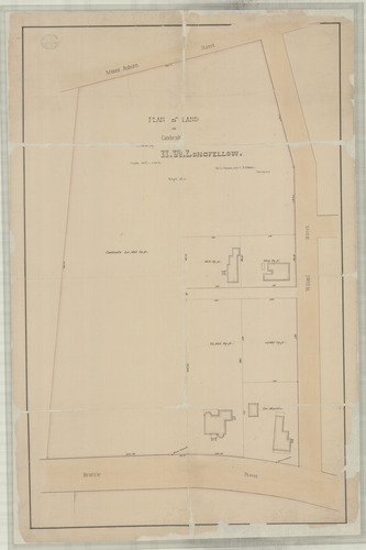
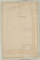
Plan of Land in Cambridge, Mass. Owned by H.W. Longfellow.
Drawing of plan showing distribution of a five lots between Brattle and Mt. Auburn streets, with measurements and square footage
Pencil and black and red ink on white paper with white linen backing, September 1871. Scale: 1" = 30'; H 80.0 x W 53.0 cm. Annotated in black ink and pencil.
Archives Number: 3002/003-#012
U. S. National Park Service
Permission must be secured from the individual copyright owners to reproduce any copyrighted materials contained within this website.
Courtesy of National Park Service, Longfellow House-Washington's Headquarters National Historic Site; Archives Number 3002/003-#012
Public domain
Assembled Drawings and Blueprints (3002/003), (LONG-SeriesName)
Image
Longfellow House - Washington's Headquarters National Historic Site, Code: LONG
Longfellow House - Washington's Headquarters National Historic Site, Middlesex County, Massachusetts
Latitude: 42.3769989013672, Longitude: -71.1264038085938
Latitude: 42.3769989013672, Longitude: -71.1264038085938
NPS Museum Number Catalog : LONG 16172
Title: Finding Aid to the Architectural Drawings and Blueprints Collection, 1847-1936
URL: https://www.nps.gov/long/learn/historyculture/archives.htm#ADC
URL: https://www.nps.gov/long/learn/historyculture/archives.htm#ADC
20210830
09/01/1871 - 09/29/1871
Architectural drawing in the Architectural Drawings and Blueprints Collection, 1847-1936, Series III, Assembled Drawings and Blueprints
Public Can View
Organization: Longfellow House-Washington's Headquarters National Historic Site
Address: 105 Brattle Street, Cambridge, MA 02138
Email: LONG_archives@nps.gov
Address: 105 Brattle Street, Cambridge, MA 02138
Email: LONG_archives@nps.gov
Tuesday, May 24, 2022 2:25:44 PM
Tuesday, May 24, 2022 2:25:44 PM
3002-003-012.jpg
jpg
5.9 MB
Historic