Select Item below to DOWNLOAD - Once item is selected, right click and choose 'save as'
b0dcc824ee7b4c26a07710e992b50eeb
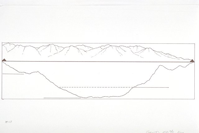
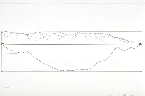
Longitudinal diagram of Lake Chelan showing its depth.
Longitudinal diagram of Lake Chelan showing its depth.
Illustration based on diagram on page 9 of the National Park Service handbook, "Stehekin."; Abbr=WE
U.S. National Park Service
Project=Lake Chelan NRA/Stehekin Valley; Reflective Art
Government owns art and all reproduction rights.
Public domain
Image
North Cascades National Park, Code: NOCA
North Cascades National Park, Washington
Latitude: 48.8278884887695, Longitude: -121.35050201416
Latitude: 48.8278884887695, Longitude: -121.35050201416
Image Management System : IMS 05618
20190904
01/01/1983 - 12/30/1983
Count:19/23; Exhibit 14/Graphic # 14-17
O 13
Public Can View
Organization: Harpers Ferry Center
Address: Harpers Ferry Center, 67 Mather Place, Harpers Ferry, WV, 25425, 304-535-5050
Address: Harpers Ferry Center, 67 Mather Place, Harpers Ferry, WV, 25425, 304-535-5050
Friday, October 4, 2019 2:07:21 PM
Friday, October 4, 2019 2:07:21 PM
05618.JPG
jpg
24.6 kB
Museum