Select Item below to DOWNLOAD - Once item is selected, right click and choose 'save as'
a96350ba-bb9a-4713-9e9d-b722333cb464
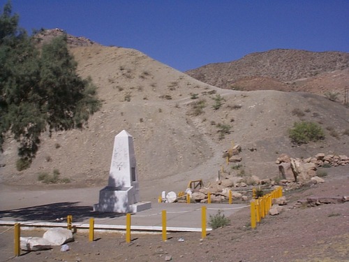
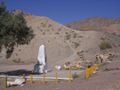
International Boundary Marker No. 1, U.S. and Mexico sits in the southern hills of El Paso, TX
A white monument in the middle of a desert.
International Boundary Marker No. 1, U.S. and Mexico sits in the southern hills of El Paso, TX; https://npgallery.nps.gov/AssetDetail/NRIS/74001195
U.S. National Park Service
Permission must be secured from the individual copyright owners to reproduce any copyrighted materials contained within this website.
Public domain
New Mexico, (ELCA States List)
Image
El Camino Real de Tierra Adentro National Historic Trail, Code: ELCA
El Paso ; International Boundary Marker No. 1, U.S. and Mexico, El Paso County, Texas
El Camino Real de Tierra Adentro National Historic Trail
El Camino Real de Tierra Adentro National Historic Trail
20010118
01/18/2001
Shot On: DC210 Zoom (V01.02); Dimensions 1152 x 846; Shot 1/250 sec. f/8 7.8mm; Size 545.7 KB
Public Can View
Organization: US National Park Service
Address: 1100 Old Santa Fe Trail, Santa Fe, New Mexico 87505, Phone:(505) 988-6098
Email: ntir_information@NPS.gov
Address: 1100 Old Santa Fe Trail, Santa Fe, New Mexico 87505, Phone:(505) 988-6098
Email: ntir_information@NPS.gov
Thursday, May 25, 2023 6:34:56 PM
Thursday, May 25, 2023 6:34:56 PM
ELCA_NM_ElPaso_BoundaryMarker_20010118_NPS_(01).JPG
jpg
558.8 kB
Scenic
,
Historic