Select Item below to DOWNLOAD - Once item is selected, right click and choose 'save as'
a87b8823-4b39-4611-9c2f-da12ed1c9aac
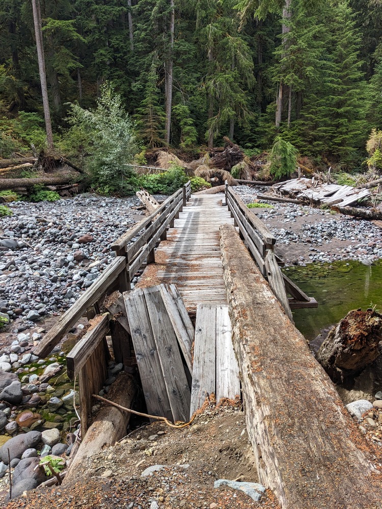
Footlog and Bridge on Carbon River Trail
A footlog to a wooden bridge crosses an algae-filled creek and gravel creek bed.
The last bridge before reaching Ipsut Creek Wilderness Campground
Permission must be secured from the individual copyright owners to reproduce any copyrighted materials contained within this website. Digital assets without any copyright restrictions are public domain.
NPS Photo
Public domain:Full Granting Rights
Image
Mount Rainier National Park, Code: MORA
Mount Rainier National Park, Washington
Latitude: 46.865608215332, Longitude: -121.682601928711
Latitude: 46.865608215332, Longitude: -121.682601928711
08/30/2023
08/30/2023
Public Can View
Thursday, August 31, 2023 5:44:27 PM
Thursday, August 31, 2023 6:19:25 PM
8.30.23_Carbon_river trail conditions (1).jpg
Google Google, Pixel 5 51, Pixel 5 back camera 4.38mm f/1.73
1111/1000000 sec at f / 1.73
4.38 mm
ISO 51
Wednesday, August 30, 2023 1:33:00 PM
jpg
4.5 MB
Scenic