Select Item below to DOWNLOAD - Once item is selected, right click and choose 'save as'
a6a13b68-a26f-44f3-8501-b2db16bc01c8
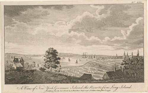
A view of New York, Governors Island, the River from Long Island
Drawing of aerial view of buildings, trees, and ships on the nearby water.
A view of New York, Governors Island, and the river from Long Island during the Revolutionary War.
This image is used for the Primus Hall (Patriot of Color) story map.
New York Public Library believes this image is public domain. For more information, see this url: https://digitalcollections.nypl.org/items/510d47db-12a7-a3d9-e040-e00a18064a99
New York Public Library
Public domain:New York Public Library believes that this image is public domain.
Image
Boston National Historical Park, Code: BOST
Boston National Historical Park, Suffolk County, Massachusetts
Latitude: 42.3734016418457, Longitude: -71.0557022094727
Latitude: 42.3734016418457, Longitude: -71.0557022094727
https://digitalcollections.nypl.org/items/510d47db-12a7-a3d9-e040-e00a18064a99
04/29/2022 | 1776
04/29/2022
Organization: New York Public Library
Friday, April 29, 2022 8:56:01 PM
Friday, April 29, 2022 9:00:11 PM
New York.jpg
Friday, April 29, 2022 4:54:16 PM
jpg
1.0 MB
Historic