Select Item below to DOWNLOAD - Once item is selected, right click and choose 'save as'
a5ff95c40b154e9a872ade95eef39596
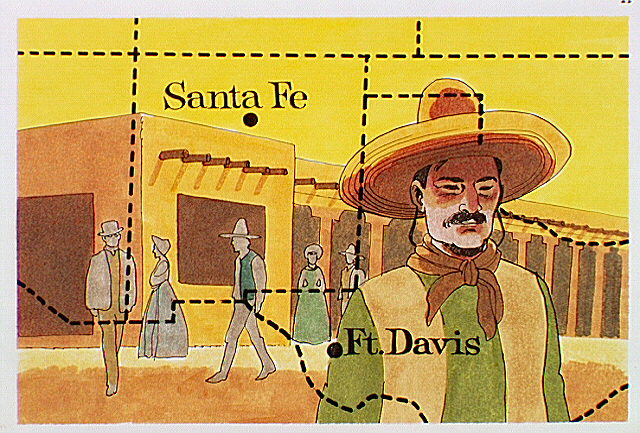
Map showing location of Fort Davis and Santa Fe superimposed over an adobe building with Mexican and Anglo settlers.
Map showing location of Fort Davis and Santa Fe superimposed over an adobe building with Mexican and Anglo settlers.
Abbr=AVA
U.S. National Park Service
Reflective Art
Government owns art and all reproduction rights.
Public domain
Image
Fort Davis National Historic Site, Code: FODA
Fort Davis National Historic Site, Jeff Davis County, Texas
Latitude: 30.5993003845215, Longitude: -103.896003723145
Latitude: 30.5993003845215, Longitude: -103.896003723145
Image Management System : IMS 01220
20190904
01/01/1979 - 12/30/1979
Image_Size=W: 10" x H: 7 1/2"; Metric_Size=W: 25.38CM X H: 17.77CM; AVA Project #43; Slide Show #252, Plate 11
B8
Public Can View
Organization: Harpers Ferry Center
Address: Harpers Ferry Center, 67 Mather Place, Harpers Ferry, WV, 25425, 304-535-5050
Address: Harpers Ferry Center, 67 Mather Place, Harpers Ferry, WV, 25425, 304-535-5050
Monday, October 7, 2019 3:06:03 PM
Monday, October 7, 2019 3:06:03 PM
01220.JPG
jpg
107.2 kB
Museum