Select Item below to DOWNLOAD - Once item is selected, right click and choose 'save as'
a5b34946-effd-496a-9a46-d615fb915268
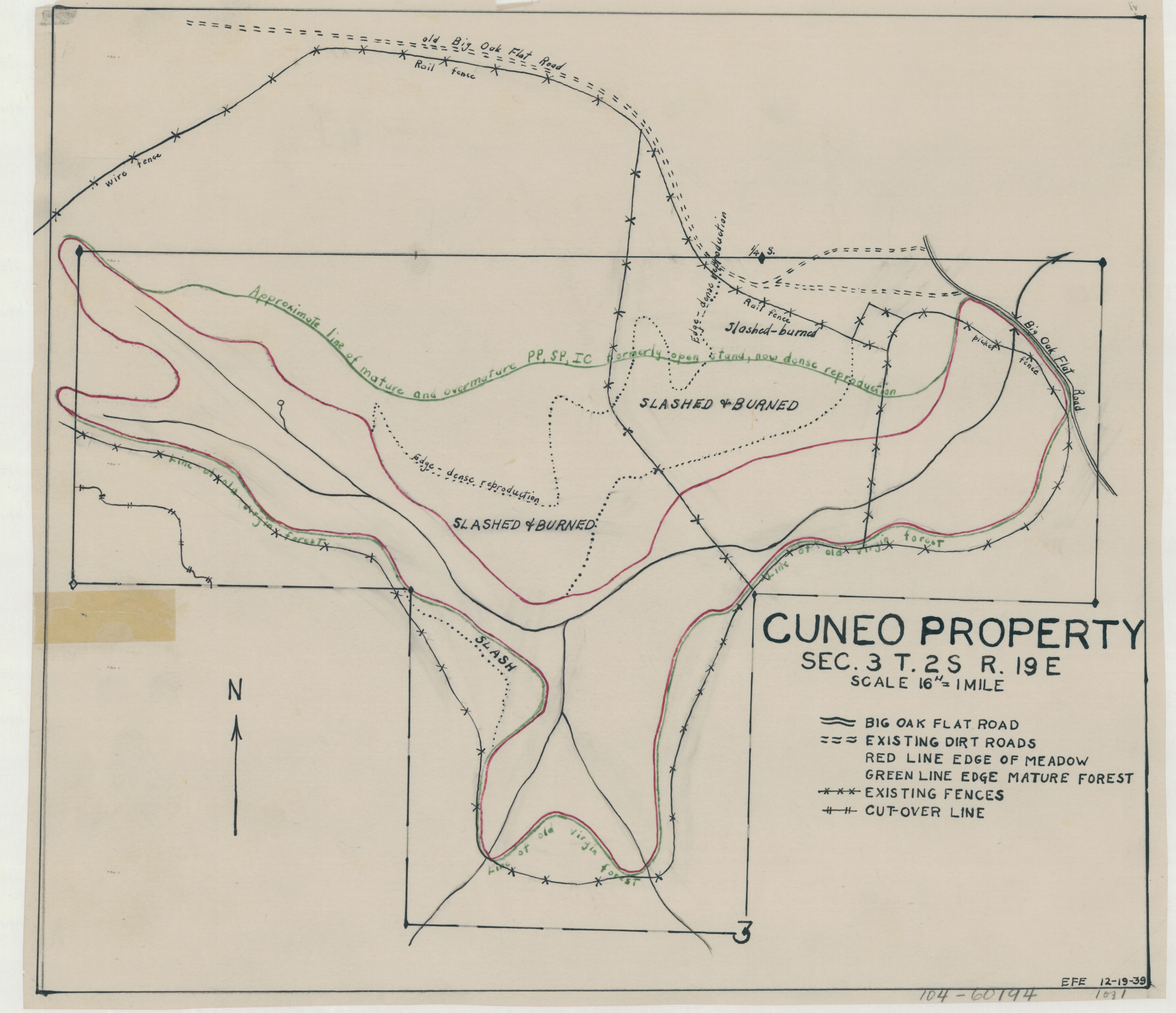
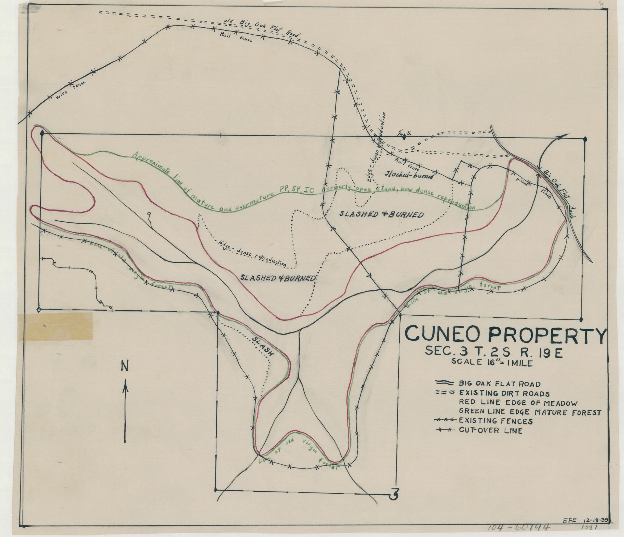
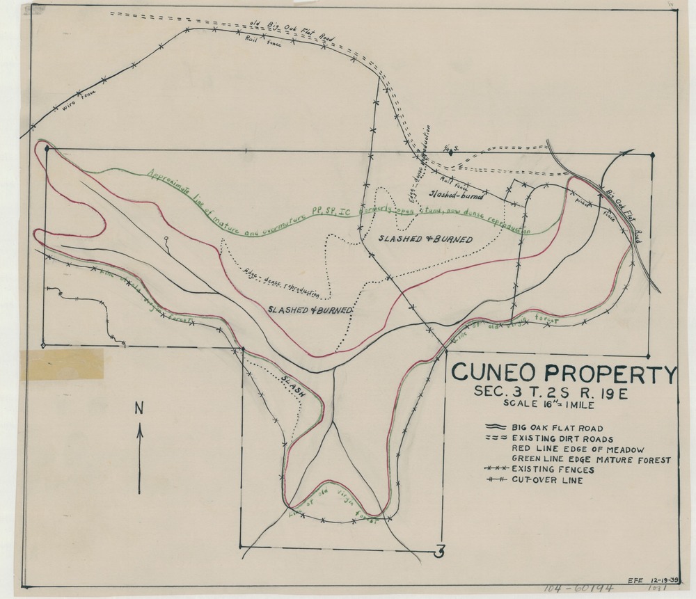
Cuneo Property
Cuneo Property
Aerial view map showing fence around property and areas that have been slashed and burn
Item Number: YOSEAR000945; TIC No: 104-60194; Alternate Id: 104-60194 1 of 1
Contact Yosemite National Park for more copyright information and use
Public domain:This digital asset is in the public domain. When using this asset for any purpose, including online, credit:'Courtesy U.S. National Parks'
60194, (YOSE TIC Number)
Image
Yosemite National Park, Code: YOSE
Yosemite National Park, California
Latitude: 37.8399200439453, Longitude: -119.540397644043
Latitude: 37.8399200439453, Longitude: -119.540397644043
1939
01/01/1939 - 12/30/1939
Type: tracing paper; Dimensions: 11.5 x 13.5; Condition: good
YOSE Location: E3 DR1 F2
Public Can View
Person: Archivist
Organization: US National Park Service
Address: Yosemite National Park Archives, PO Box 700-W, El Portal, CA 95318
Email: yose_archives@nps.gov
Organization: US National Park Service
Address: Yosemite National Park Archives, PO Box 700-W, El Portal, CA 95318
Email: yose_archives@nps.gov
Monday, July 25, 2022 3:42:53 PM
Monday, July 25, 2022 3:42:53 PM
YOSEAR000945.tif
tif
24.6 MB
Scenic
,
Map