Select Item below to DOWNLOAD - Once item is selected, right click and choose 'save as'
a5a0a4ef-de7a-4c09-ab25-a44874e2c034
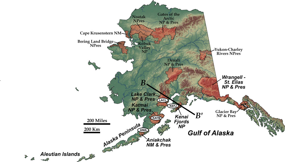
NPS Sites in Alaska Subduction Zone
shaded relief map of alaska showing nps units
Letters in ovals refer to NPS sites that lie on the accretionary wedge and volcanic arc formed by northward subduction of the Pacific Plate beneath southern Alaska. Those sites, as well as Wrangell–St. Elias and Denali national parks, are also included in the “Accreted Terranes” part of these web pages. Sites in northern Alaska are in the Brooks Range, discussed in the “Collisional Mountain Range” web pages. B–B’ is the line of cross section in [the next] illustration.
Permission must be secured from the individual copyright owners to reproduce any copyrighted materials contained within this website. Digital assets without any copyright restrictions are public domain.
Modified from “Parks and Plates: The Geology of our National Parks, Monuments and Seashores,” by Robert J. Lillie, New York, W. W. Norton and Company, 298 pp., 2005, www.amazon.com/dp/0134905172.
Public domain:Full Granting Rights
Image
Geologic Resources Division, Code: GRD
01/21/2020
01/21/2020
Public Can View
Friday, January 31, 2020 5:20:24 PM
Friday, January 31, 2020 5:20:24 PM
fig 4-14 alaska nps subduction sites new@10x.jpg
Tuesday, January 21, 2020 10:02:49 PM
jpg
3.9 MB
Scenic