Select Item below to DOWNLOAD - Once item is selected, right click and choose 'save as'
a19d1eac-4320-47b6-8781-e1142eda6a84
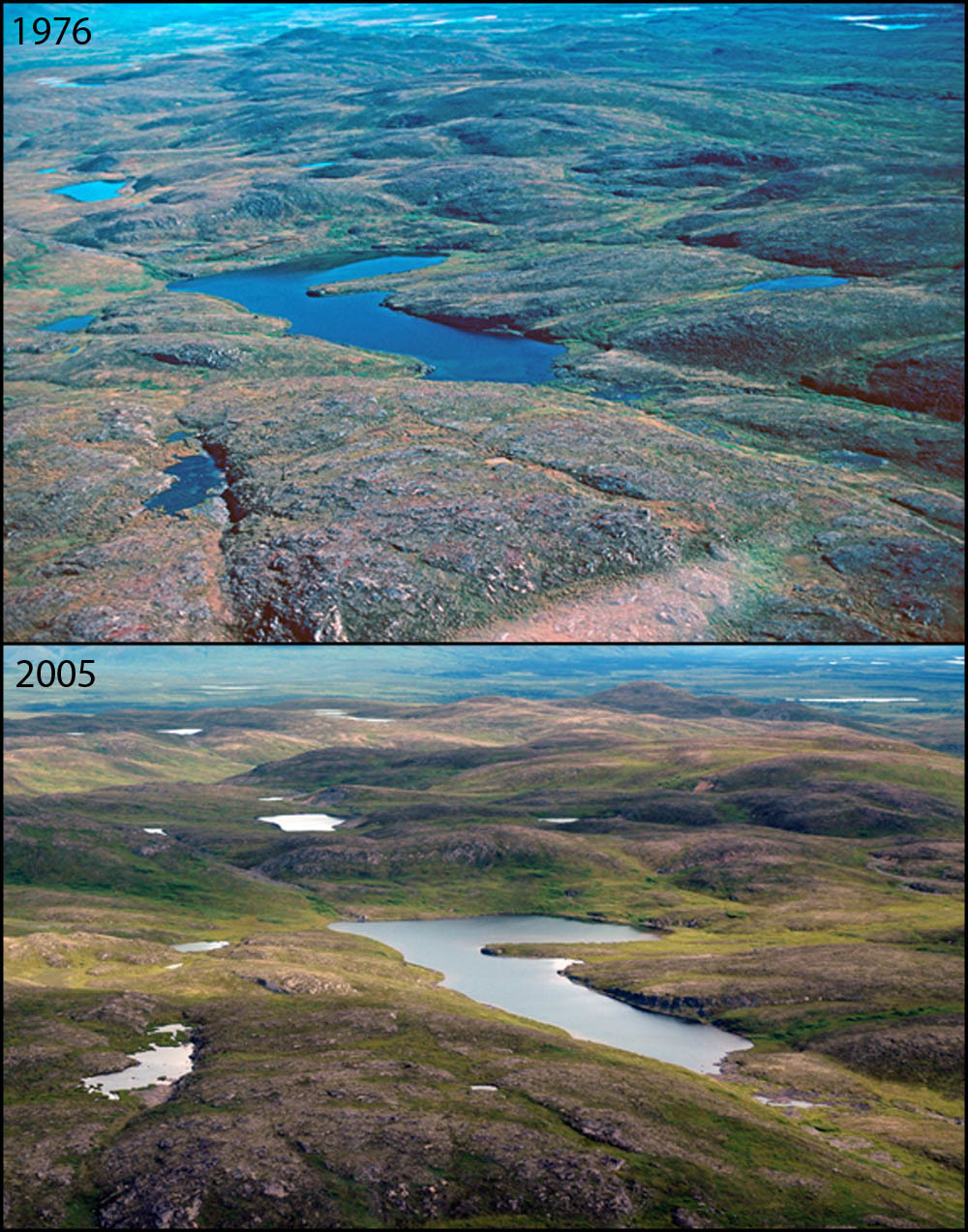
No Apparent Changes at Bull River: 1976-2005
A photo pair showing No Apparent Changes at Bull River: 1976-2005
This photo pair shows two views of an alpine lake above Costello Creek in the Broad Pass area. This area was inundated by glacial ice 20,000 years ago, which scoured out the pattern of ridges and depressions that you see in the photos. Once the ice sheets melted, water filled the depressions to form the ponds present on the landscape today. Current vegetation in the area is low alpine tundra dominated by heath family plants and mountain avens on the knobs and wet sedge-dominated communities in the low areas ringing the ponds.
Original year: 1976; Rephoto year: 2005
U.S. National Park Service
Photos and photo pairs are pre-approved for educational use ONLY. To use them in educational products, credit them the same way as they are credited on the website, Photo Credit: Original photographer: Fred Dean; Rephoto photographer: Carl Roland. For any other use beyond education, contact Denali National Park and Preserve for additional copyright information on specific images of interest.
Original photographer: Fred Dean; Rephoto photographer: Carl Roland
Restrictions apply on use and/or reproduction
Image
Denali National Park and Preserve, Code: DENA
Bull River, South Central mountains, Alaska
Latitude: 63.251491, Longitude: -149.477861
Denali National Park and Preserve, Alaska
Latitude: 63.3182792663574, Longitude: -150.602905273438
Latitude: 63.251491, Longitude: -149.477861
Denali National Park and Preserve, Alaska
Latitude: 63.3182792663574, Longitude: -150.602905273438
2012/06/25
Public Can View
Person: Digital Manager
Organization: US National Park Service
Address: Denali National Park and Preserve, P.O. Box 9, Denali Park, AK 99755
Organization: US National Park Service
Address: Denali National Park and Preserve, P.O. Box 9, Denali Park, AK 99755
Thursday, June 6, 2024 4:50:24 PM
Thursday, June 6, 2024 4:50:24 PM
112712_31.jpg
jpg
301.4 kB
Scenic
,
Historic
,
Monitoring