Select Item below to DOWNLOAD - Once item is selected, right click and choose 'save as'
9b5eb333-f65c-478f-a514-88eb8a9d71af
Werowocomoco
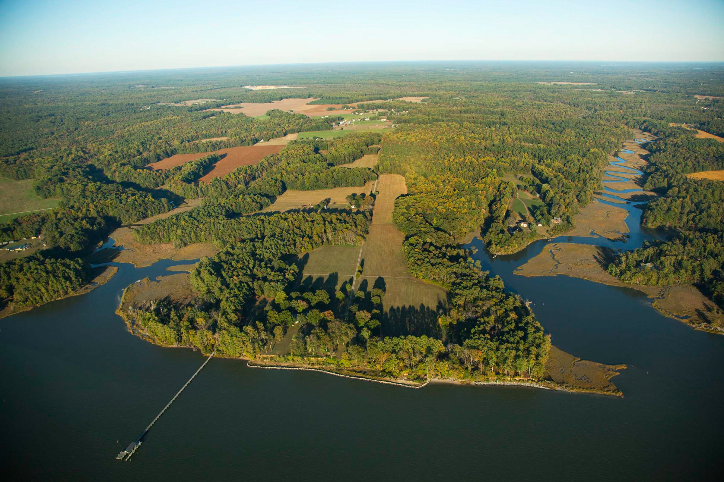
Aerial view of a river shoreline with fields and forest stretching out into the distance. A pier is visible in the foreground.
Aerial view of Werowocomoco, once the capital of the Powhatan Chiefdom and a sacred site that has been inhabited for thousands of years.
Copyright: John Henley Photography
John Henley
Public domain:Full Granting Rights
Image
Captain John Smith Chesapeake National Historic Trail, Code: CAJO
Captain John Smith Chesapeake National Historic Trail
Latitude: 38.7776985168457, Longitude: -77.0294036865234
Latitude: 38.7776985168457, Longitude: -77.0294036865234
10/19/2009
10/19/2009
Public Can View
Photographer: John Henley
Wednesday, February 17, 2021 3:23:05 PM
Wednesday, February 17, 2021 3:23:05 PM
Werowocomoco.jpg
jpg
1.8 MB
Scenic