Select Item below to DOWNLOAD - Once item is selected, right click and choose 'save as'
97a6bc4e-6c78-49ea-8123-0c095cef981c
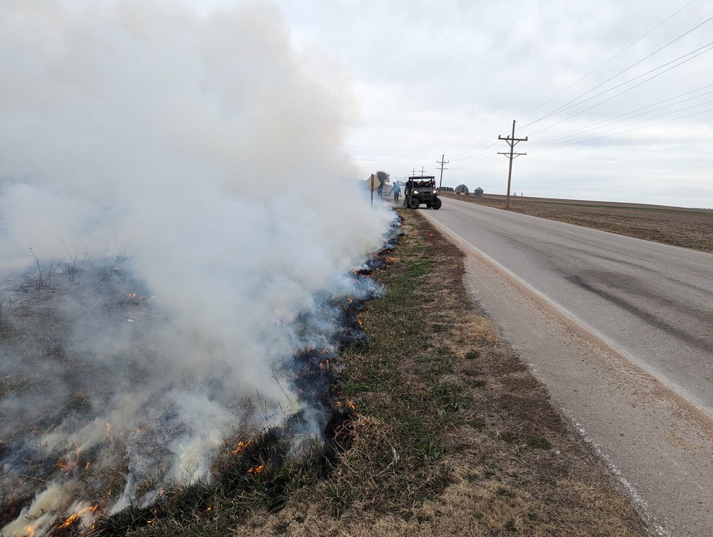
Burn day weather
Smoke, seen right next to the road, blows away from the road. A UTV is stationed to direct traffic if weather conditions change.
The prescribed fire at the Freeman School was initially considered on March 5, but ultimately postponed due to more suitable wind conditions predicted on March 6. As predicted, the winds blew the smoke away from roads, allowing for safe conditions for the fire crew, the historic structures, and the public.
On March 5 and 6, 2024, 15 firefighters representing 4 agencies and 3 parks executed two successful prescribed burns at Homestead National Historical Park. A successful burn reduces fuels in an area which might otherwise experience less controlled fire. It also helps reinforce local and fire adapted plants while promoting new growth.
Robert Hartwig
NPS/Robert Hartwig
Public domain:Full Granting Rights
Image
Homestead National Historical Park, Code: HOME
Homestead National Historical Park, Gage County, Nebraska
Latitude: 40.2879981994629, Longitude: -96.8339004516602
Latitude: 40.2879981994629, Longitude: -96.8339004516602
03/06/2024 | NPS/Robert Hartwig
01/01/0001
Public Can View
Hartwig, Robert A
Thursday, April 11, 2024 4:39:58 PM
Thursday, April 11, 2024 4:56:35 PM
75_rh.jpg
Monday, January 1, 0001 12:00:00 AM
jpg
426.8 kB
Scenic