Select Item below to DOWNLOAD - Once item is selected, right click and choose 'save as'
978be2bf-5263-45f9-8e37-286399982cbc
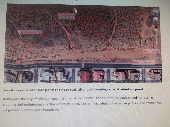
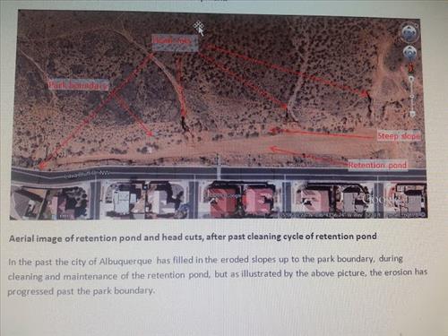
Retention Pond Erosion along PETR Boundary
Permission must be secured from the individual copyright owners to reproduce any copyrighted materials contained within this website. Digital assets without any copyright restrictions are public domain.
Public domain
Image
Petroglyph National Monument, Code: PETR
Petroglyph National Monument, Bernalillo County, New Mexico
Latitude: 35.1231994628906, Longitude: -106.758003234863
Latitude: 35.1231994628906, Longitude: -106.758003234863
Legacy NPS Focus Record ID : 499028
01/31/2014
Public Can View
Friday, January 31, 2014 8:43:11 AM
Thursday, August 10, 2017 3:14:11 AM
PETR-bd4707dd3b43486dbee24aeade8c0719.jpg
Monday, January 1, 0001 12:00:00 AM
jpg
117.0 kB