Select Item below to DOWNLOAD - Once item is selected, right click and choose 'save as'
93a01961-0d4e-47e3-80cc-2dbd798f0d98
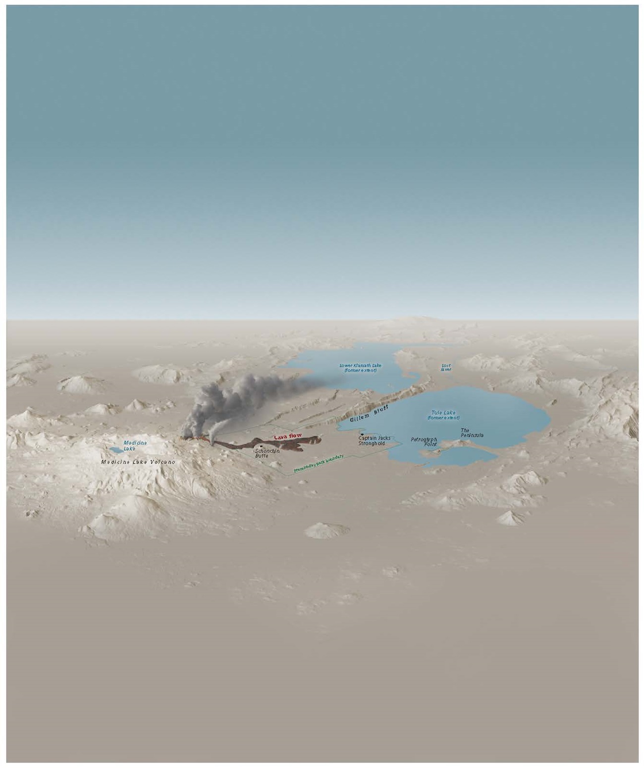
Volcano Map - Lava Beds National Monument
Perspective map of Lava Beds National Monument in California. The active Medicine Lake Volcano erupts, showing plumes of smoke emerging from the lava flow. The present-day park boundary and surrounding terrain are shown in shades of brown to the northeast of the volcano.
Screen-viewable file; Adobe print production files can be downloaded from the Compressed zip Version link
Map Projection: Other; Map Type: unassigned
U.S. National Park Service
The National Park Service maps are government produced and are in the public domain. Anyone may, without restriction under U.S. copyright laws: Reproduce the work in print or digital form; Create derivative works; Perform the work publicly; Display the work; Distribute copies or digitally transfer the work to the public by sale or other transfer of ownership, or by rental, lease, or lending. Please note, a user who modifies and/or republishes National Park Service maps are responsible for any problems encountered with the maps, due to their change or modification.
Public domain
Document
Lava Beds National Monument, Code: LABE
Lava Beds National Monument, California
Latitude: 41.7614593505859, Longitude: -121.521301269531
Latitude: 41.7614593505859, Longitude: -121.521301269531
2015-10-08
Public Can View
Person: Harpers Ferry Center
Organization: US National Park Service
Address: Harpers Ferry Center, Harpers Ferry, WV
Email: HFC_Cartography@nps.gov
Organization: US National Park Service
Address: Harpers Ferry Center, Harpers Ferry, WV
Email: HFC_Cartography@nps.gov
Thursday, May 15, 2025 3:15:15 PM
Friday, September 26, 2025 11:36:16 PM
LABEmap4.pdf
pdf
13.4 MB
Map