Select Item below to DOWNLOAD - Once item is selected, right click and choose 'save as'
The National Park Service is committed to making its electronic and information technologies accessible to individuals with disabilities.
If you require assistance or wish to report an issue related to the accessibility of any content on this website, please email NPGallery@nps.gov
If you require assistance or wish to report an issue related to the accessibility of any content on this website, please email NPGallery@nps.gov
939b95c9-0c09-4c20-8c65-c1be52c78754
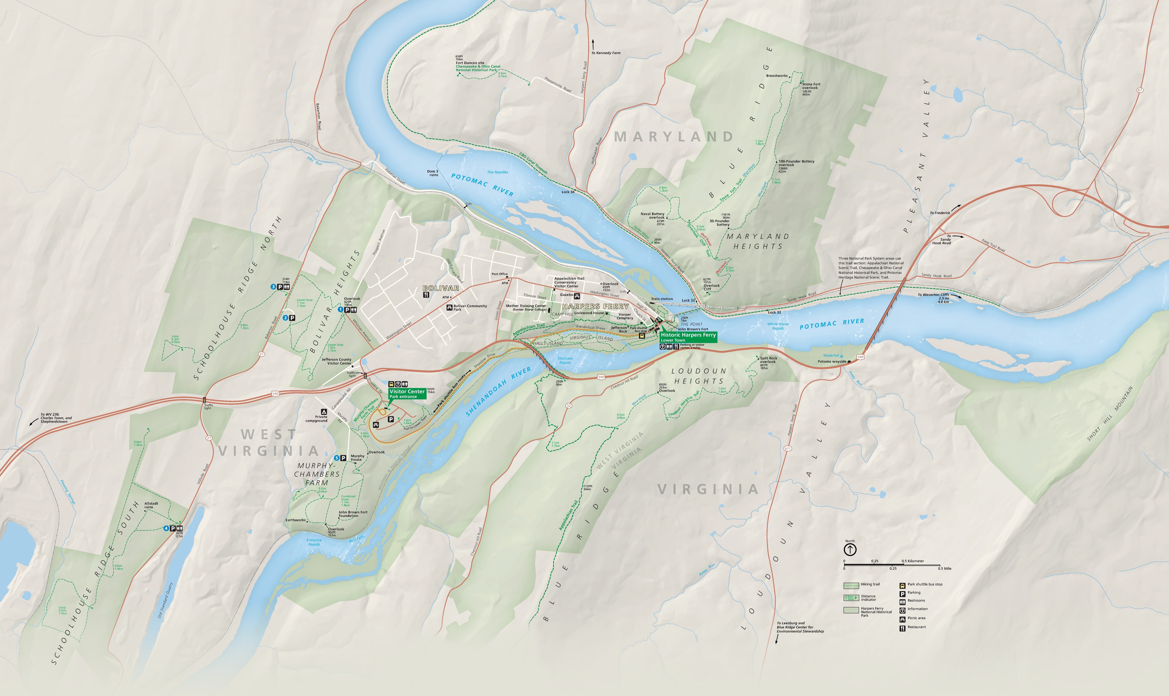
Park Map - Harpers Ferry National Historical Park
Map of Harpers Ferry National Historical Park where Maryland, Virginia, and West Virginia meet. The park is highlighted in green with the surrounding area in tan. A sideways-oriented Y-shaped river cuts through the park. Major highways are represented by orange lines, the street grid by white lines, and trails by dashed green lines.
Screen-viewable file; Adobe print production files can be downloaded from the Compressed zip Version link
Map Projection: WM; Map Type: park map
U.S. National Park Service
The National Park Service maps are government produced and are in the public domain. Anyone may, without restriction under U.S. copyright laws: Reproduce the work in print or digital form; Create derivative works; Perform the work publicly; Display the work; Distribute copies or digitally transfer the work to the public by sale or other transfer of ownership, or by rental, lease, or lending. Please note, a user who modifies and/or republishes National Park Service maps are responsible for any problems encountered with the maps, due to their change or modification.
Public domain
Document
Harpers Ferry National Historical Park, Code: HAFE
Virginia ; West Virginia, Harpers Ferry National Historical Park, Washington County, Maryland
Latitude: 39.3241004943848, Longitude: -77.7242965698242
Latitude: 39.3241004943848, Longitude: -77.7242965698242
2022-08-01
08/01/2022
Public Can View
Person: Harpers Ferry Center
Organization: US National Park Service
Address: Harpers Ferry Center, Harpers Ferry, WV
Email: HFC_Cartography@nps.gov
Organization: US National Park Service
Address: Harpers Ferry Center, Harpers Ferry, WV
Email: HFC_Cartography@nps.gov
Friday, July 28, 2023 5:16:38 PM
Friday, September 26, 2025 11:35:43 PM
HAFEmap1.pdf
pdf
25.5 MB
Map