Select Item below to DOWNLOAD - Once item is selected, right click and choose 'save as'
9399d912-8c1f-4f4e-920a-fcd62bff0126
September 21, Little Round Top Update
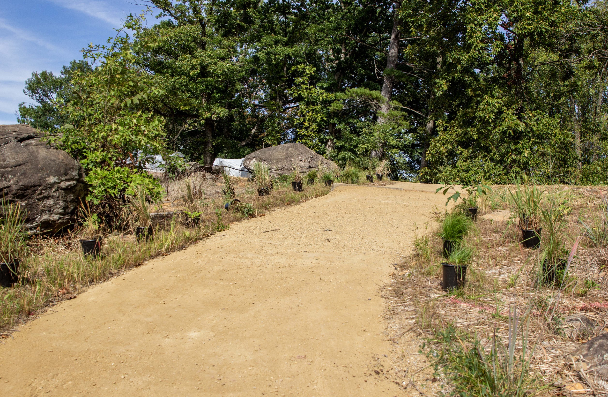
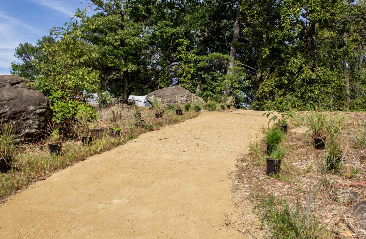
A light brown gravel trail leads up a hill and disappears. Small black containers of grass line both sides of the trail. Tall green leaf trees stand at the summit of the hill.
The edges of the stabilized aggregate trail, that leads from the 140th New York monument up to the summit of the hill, have containers of native grasses lined up along its edges. These native grasses will be planted along the edge of many of the trails as part of the rehabilitation project.
Permission must be secured from the individual copyright owners to reproduce any copyrighted materials contained within this website. Digital assets without any copyright restrictions are public domain.
NPS Photo
Public domain:Full Granting Rights
Image
Gettysburg National Military Park, Code: GETT
Gettysburg National Military Park, Adams County, Pennsylvania
Latitude: 39.804500579834, Longitude: -77.2384033203125
Latitude: 39.804500579834, Longitude: -77.2384033203125
09/21/2023
09/21/2023
Public Can View
Friday, October 20, 2023 12:37:28 AM
Friday, October 20, 2023 12:51:44 AM
Jason_9-21-23_0015.jpg
Canon Canon, Canon EOS 60D 200, EF24-105mm f/4L IS II USM
1/1600 sec at f / 5
24 mm
ISO 200
Thursday, September 21, 2023 3:48:54 PM
jpg
2.6 MB
Scenic