Select Item below to DOWNLOAD - Once item is selected, right click and choose 'save as'
92aa3d19-0a4a-42e2-abe2-7b9f25d3c065
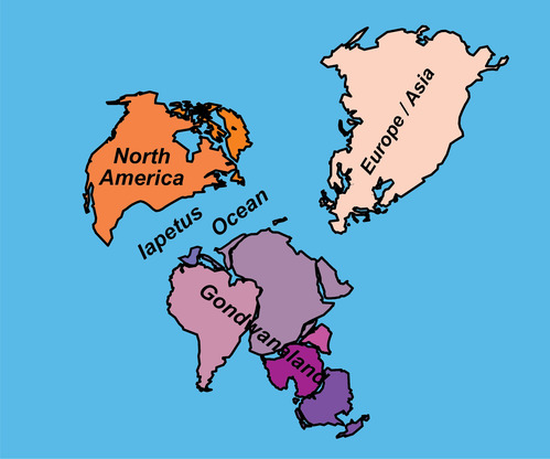
Tectonic Development of the Appalachian—Ouachita—Marathon Mountain Range (1 of 3)
map of the world showing location of continents 500 million years ago
500 Million Years Ago—Iapetus Ocean Opens. Land that will later become Florida is part of Africa. The Yucatan Peninsula and Cuba may have been on the north side of South America.
Permission must be secured from the individual copyright owners to reproduce any copyrighted materials contained within this website. Digital assets without any copyright restrictions are public domain.
Modified from “Parks and Plates: The Geology of our National Parks, Monuments and Seashores,” by Robert J. Lillie, New York, W. W. Norton and Company, 298 pp., 2005, www.amazon.com/dp/0134905172.
Public domain:Full Granting Rights
Image
Geologic Resources Division, Code: GRD
11/22/2019
11/22/2019
Public Can View
Monday, February 3, 2020 10:17:13 AM
Monday, February 3, 2020 10:17:13 AM
iapetus open@10x.jpg
Friday, November 22, 2019 5:31:43 PM
jpg
427.4 kB
Scenic