Select Item below to DOWNLOAD - Once item is selected, right click and choose 'save as'
9113e79c-3a64-480a-af52-83e65cf1130d
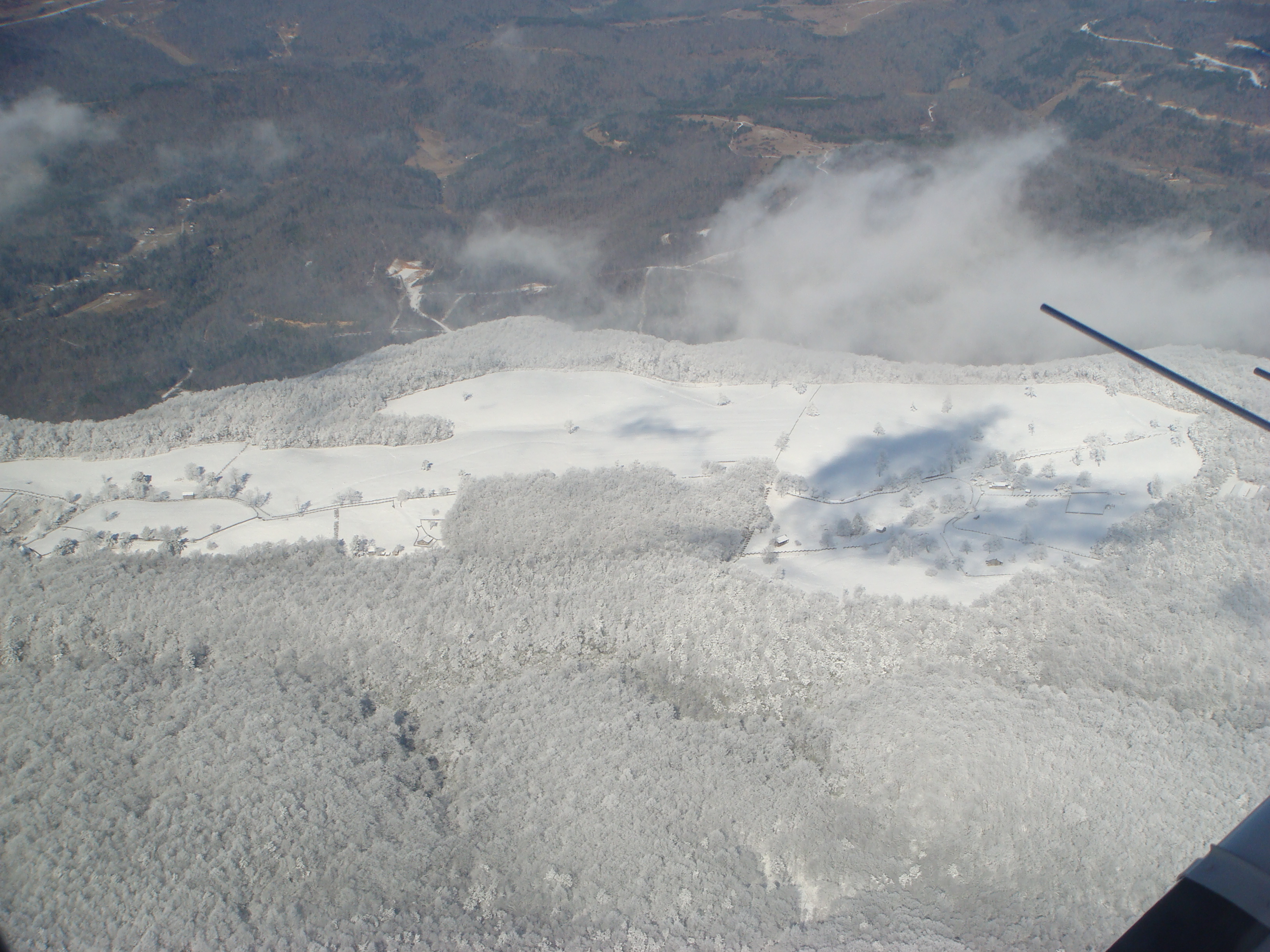
Hensley Settlement Fences
Hensley Settlement fences (paling/pickett, worm and stacked rail). Aerial view of HS fences.
Permission must be secured from the individual copyright owners to reproduce any copyrighted materials contained within this website. Digital assets without any copyright restrictions are public domain.
Public domain
Image
Cumberland Gap National Historical Park, Code: CUGA
Cumberland Gap National Park ; Hensley Settlement, Cumberland Gap National Historical Park
Latitude: 36.6312599182129, Longitude: -83.6063537597656
Latitude: 36.6312599182129, Longitude: -83.6063537597656
01/21/2009
01/01/2007 - 12/31/2008
Public Can View
Monday, January 14, 2013 1:20:01 PM
Thursday, August 10, 2017 2:28:56 AM
CUGA-dda98304a7804a0fb06c446a571f912b.jpg
SONY SONY, DSC-T100
10/6400 sec at f / 5.6
8.83 mm
ISO 100
Wednesday, January 21, 2009 7:48:23 PM
jpg
2.6 MB
Budget