Select Item below to DOWNLOAD - Once item is selected, right click and choose 'save as'
910dd491-61ff-4b9a-90c5-76e96c7f0872
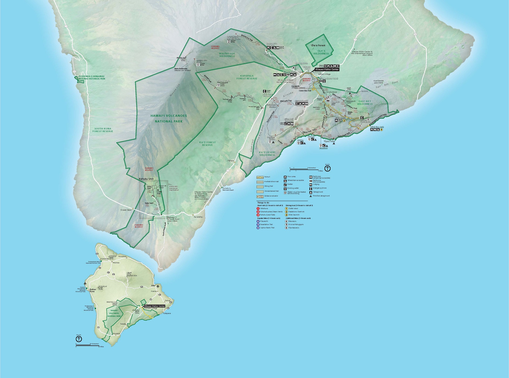
Park Map - Hawaii Volcanoes National Park
Map of Hawaiʻi Volcanoes National Park in Hawaii. Parks, wildernesses, and reserve areas are outlined in green along the southern coastline of the Island of Hawaiʻi, and the surrounding terrain is shaded pale green and frosty gray to represent the island’s forests, deserts, and volcanic zones.
Screen-viewable file; Adobe print production files can be downloaded from the Compressed zip Version link
Map Projection: 3D; Map Type: park map
U.S. National Park Service
The National Park Service maps are government produced and are in the public domain. Anyone may, without restriction under U.S. copyright laws: Reproduce the work in print or digital form; Create derivative works; Perform the work publicly; Display the work; Distribute copies or digitally transfer the work to the public by sale or other transfer of ownership, or by rental, lease, or lending. Please note, a user who modifies and/or republishes National Park Service maps are responsible for any problems encountered with the maps, due to their change or modification.
Public domain
Document
Hawaii Volcanoes National Park, Code: HAVO
Hawaii Volcanoes National Park, Hawaii County, Hawaii
Latitude: 19.3775997161865, Longitude: -155.602996826172
Latitude: 19.3775997161865, Longitude: -155.602996826172
2023/11/01
2023-11-01
Public Can View
Person: Harpers Ferry Center
Organization: US National Park Service
Address: Harpers Ferry Center, Harpers Ferry, WV
Email: HFC_Cartography@nps.gov
Organization: US National Park Service
Address: Harpers Ferry Center, Harpers Ferry, WV
Email: HFC_Cartography@nps.gov
Wednesday, January 15, 2025 3:15:15 PM
Friday, September 26, 2025 11:35:46 PM
HAVOIslandmap.pdf
pdf
70.1 MB
Map