Select Item below to DOWNLOAD - Once item is selected, right click and choose 'save as'
90bf8e0b-0aa9-44f6-a075-90add39b57ae
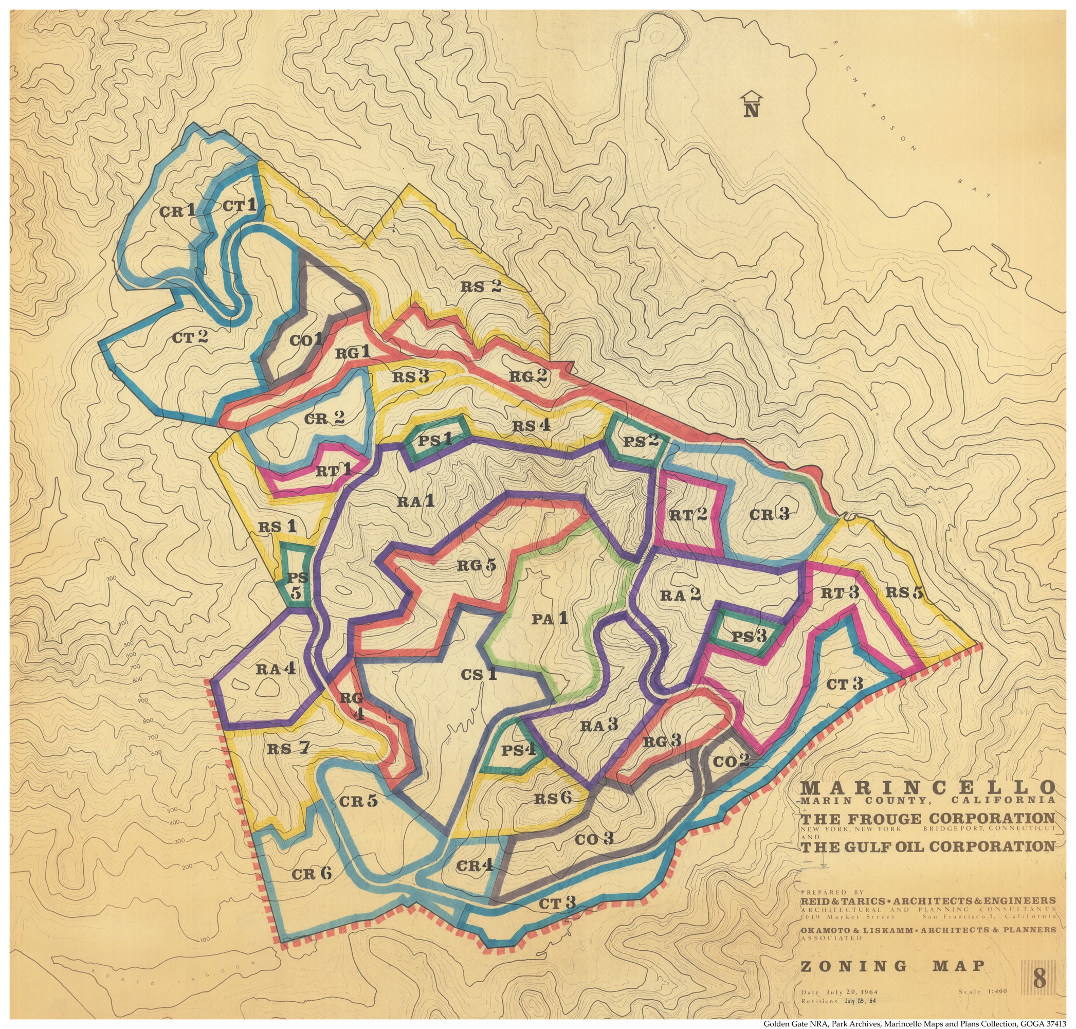
Zoning 1964
Colorful zoning map for the Marincello project
Golden Gate NRA, Park Archives, Marincello Maps and Plans Collection, GOGA 37413
Public domain
Image
Golden Gate National Recreation Area, Code: GOGA
Golden Gate National Recreation Area, California
Latitude: 37.8916893005371, Longitude: -122.635803222656
Latitude: 37.8916893005371, Longitude: -122.635803222656
ICMS (Interior Collection Managment System) : GOGA 37413
1964-1972
1964-1972
Public Can View
Organization: Golden Gate NRA Museum Program
Wednesday, November 1, 2023 3:26:29 PM
Wednesday, November 1, 2023 4:06:58 PM
GOGA 37413-004 Zoning Map 1964.tif
Friday, October 13, 2023 7:48:47 AM
tif
1072.3 MB
Scenic
,
Historic
,
Events