Select Item below to DOWNLOAD - Once item is selected, right click and choose 'save as'
8edf6e21-61f9-47ae-a540-6303b8ea6f06
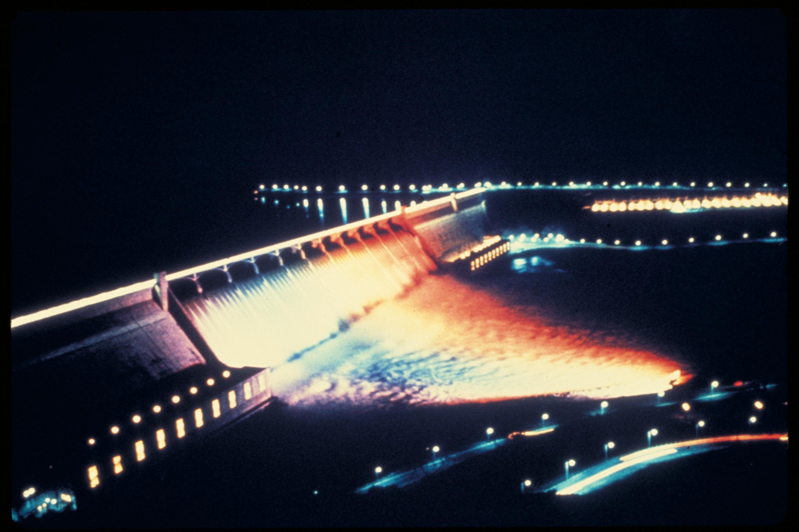
Lake Roosevelt National Recreation Area, Washington
The Upper Columbia River is rich in cultural and natural significance. For more than 9000 years, people have gathered along the banks of the river to fish and trade with each other. Missionaries and explorers for the Hudson Bay Company and the Northwest Trading Company mapped the area and developed relationships with the tribes, which lived here. In 1941, damming of the Columbia River as part of the Columbia River Basin project created a 130-mile long lake. Named for President Franklin D. Roosevelt, the lake is now the largest recreation feature in the Lake Roosevelt National Recreation Area.
Dam at night
National Park Service
Permission must be secured from the individual copyright owners to reproduce any copyrighted materials contained within this website. Digital assets without any copyright restrictions are public domain.
Public domain
Image
Lake Roosevelt National Recreation Area, Code: LARO
Lake Roosevelt National Recreation Area, Washington
Latitude: 47.8406715393066, Longitude: -118.434700012207
Latitude: 47.8406715393066, Longitude: -118.434700012207
Legacy NPS Focus Record ID : 231497
Title: NPS Office of Communications and Public Affairs Photo Library
URL: http://www.nps.gov/pub_aff/imagebase.html
URL: http://www.nps.gov/pub_aff/imagebase.html
01/05/2004
01/01/1980 - 12/30/1999
Digital image (TIF ; 18.0 MB; 3072 x 2048 ; 300 dpi; 24 bit color). Encoded as MrSID format
Public Can View
Wednesday, September 29, 2004 6:26:09 PM
Thursday, August 10, 2017 2:19:31 AM
coda_damatnight_5032.jpg
Monday, January 1, 0001 12:00:00 AM
jpg
409.4 kB
Inventory
,
Map