Select Item below to DOWNLOAD - Once item is selected, right click and choose 'save as'
8cdab107712e4a938a34a97c22602b8e
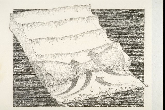
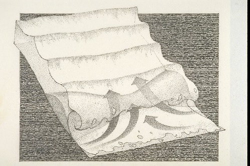
Diagram of a seaward current.
Diagram of a seaward current.
Abbr=WE
U.S. National Park Service
Reflective Art
Government owns art and all reproduction rights.
Public domain
Image
Point Reyes National Seashore, Code: PORE
Point Reyes National Seashore, Marin County, California
Latitude: 38.0550003051758, Longitude: -122.879997253418
Latitude: 38.0550003051758, Longitude: -122.879997253418
Image Management System : IMS 04422
20190904
01/01/1981 - 12/30/1981
Exhibit 8: Dangerous Surf/Graphic # 8-8
I 12
Public Can View
Organization: Harpers Ferry Center
Address: Harpers Ferry Center, 67 Mather Place, Harpers Ferry, WV, 25425, 304-535-5050
Address: Harpers Ferry Center, 67 Mather Place, Harpers Ferry, WV, 25425, 304-535-5050
Friday, October 4, 2019 2:24:32 PM
Friday, October 4, 2019 2:24:32 PM
04422.JPG
jpg
84.9 kB
Museum