Select Item below to DOWNLOAD - Once item is selected, right click and choose 'save as'
8ae96799-8af4-40ce-8366-59dbaa878764
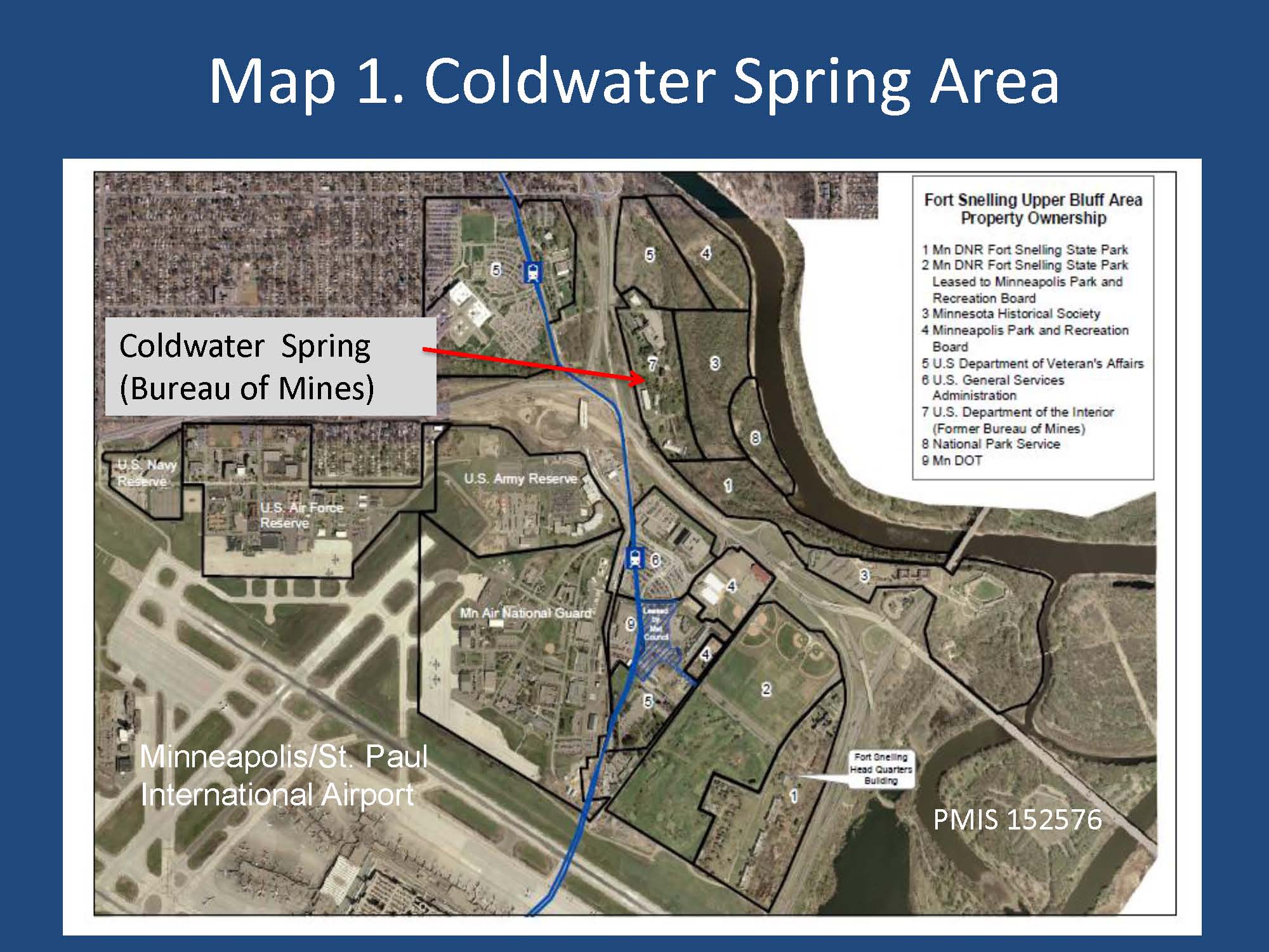
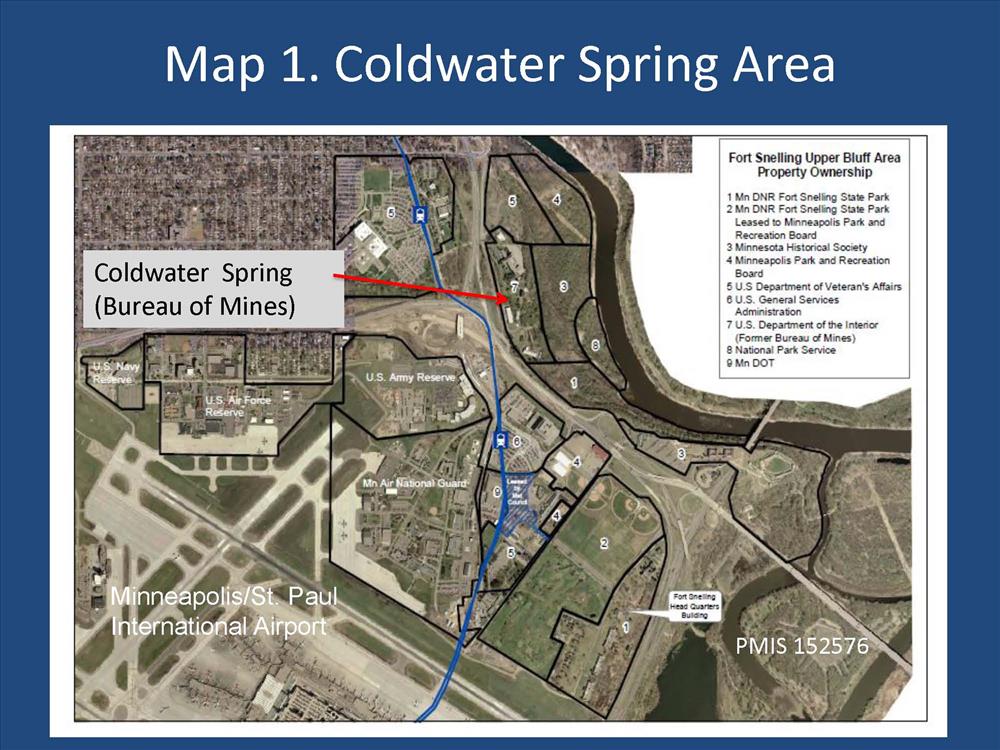
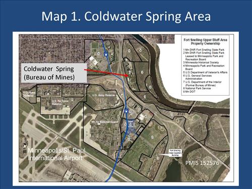
BOM Maps 1 and 2
Permission must be secured from the individual copyright owners to reproduce any copyrighted materials contained within this website. Digital assets without any copyright restrictions are public domain.
Public domain
Image
Mississippi National River and Recreation Area, Code: MISS
Mississippi National River and Recreation Area, Minnesota
Latitude: 44.9146118164063, Longitude: -93.1276016235352
Latitude: 44.9146118164063, Longitude: -93.1276016235352
Public Can View
Friday, February 3, 2012 2:25:14 PM
Thursday, August 10, 2017 1:48:48 AM
MISS-bb2aaaf736124c56a3a9e6ed5651c7bb.jpg
Monday, January 1, 0001 12:00:00 AM
jpg
255.4 kB
Map
,
Budget