Select Item below to DOWNLOAD - Once item is selected, right click and choose 'save as'
7df8f79e-1761-4967-a358-64b4e9a4d1c3
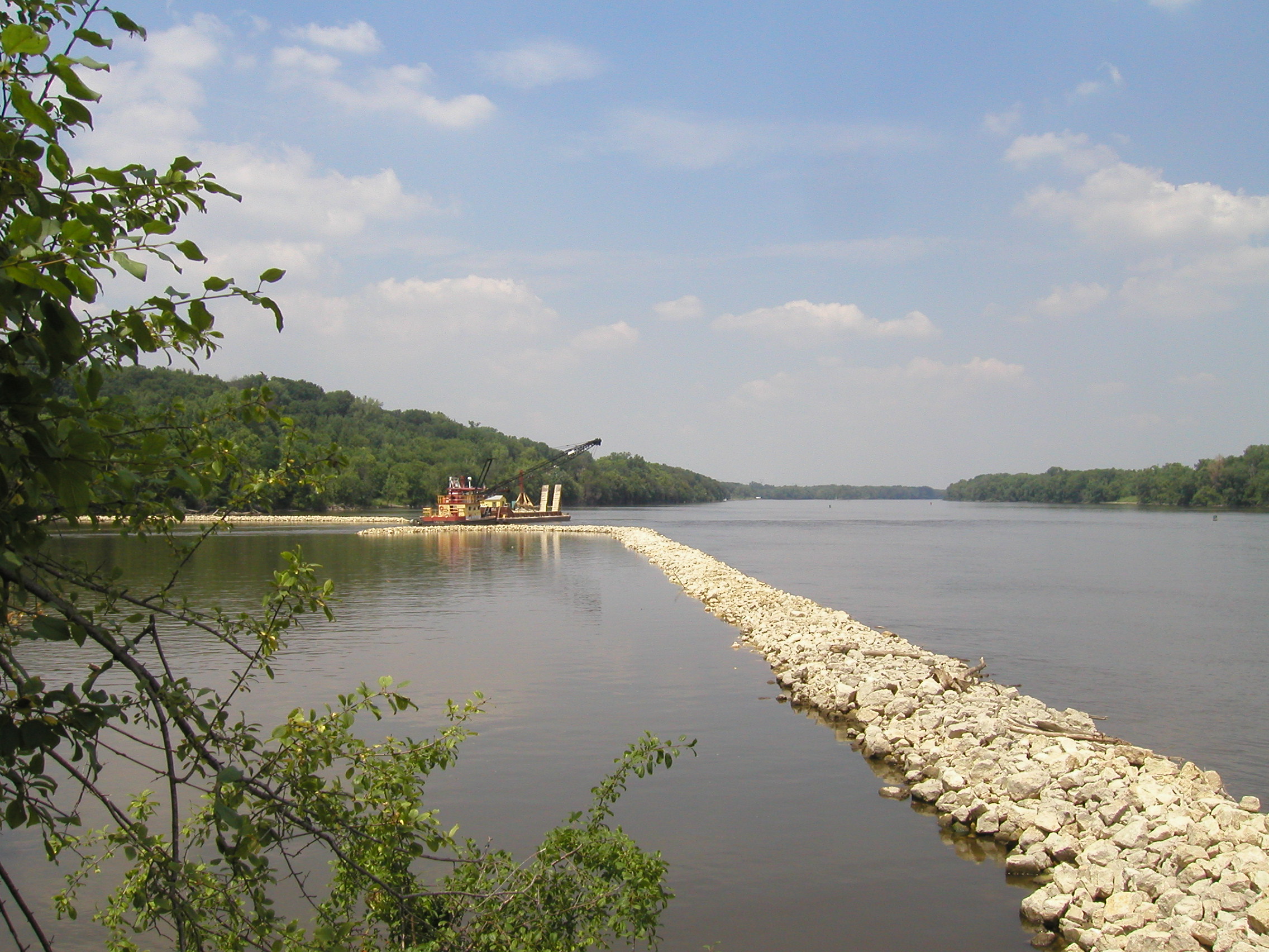
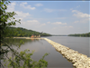
Construction of river channel closing structure in the Mississippi NRRA
This series of photos was taken on July 12, 2005, on and near NPS Island 112-02 during a canoe safety training for new staff. The images depict construction by the U.S. Army Corps of Engineers of a partial closing structure made of riprap, dredged material and live plant material. The purpose of the structure is to control erosion on the upstream end of the island and to create new wildlife habitat. This project is part of the Corps' Channel Maintenance Management Plan. NPS Island 112-02 is located in Mississippi River Pool 2 at River Mile 827.5
from north end of island, facing upstream
U.S. National Park Service
Permission must be secured from the individual copyright owners to reproduce any copyrighted materials contained within this website. Digital assets without any copyright restrictions are public domain.
Public domain
Rivers, ()
, Islands, ()
, Construction and Engineering, ()
, Wildlife management, ()
, Vegetation restoration, ()
, Islands, ()
, Construction and Engineering, ()
, Wildlife management, ()
, Vegetation restoration, ()
Image
Mississippi National River and Recreation Area, Code: MISS
NPS Island 112-02, Mississippi National River and Recreation Area, Minnesota
Latitude: 44.9146118164063, Longitude: -93.1276016235352
Latitude: 44.9146118164063, Longitude: -93.1276016235352
Legacy NPS Focus Record ID : 233177
07/12/2005
07/12/2005
Public Can View
Thursday, July 13, 2006 3:58:54 PM
Thursday, August 10, 2017 12:34:46 AM
MISS-2108e158ae0842318bac7c66351bd1ce.jpg
OLYMPUS OPTICAL CO.,LTD OLYMPUS OPTICAL CO.,LTD, C40Z,D40Z
10/4000 sec at f / 8
7.5 mm
ISO 100
Tuesday, July 12, 2005 7:47:10 PM
jpg
884.6 kB
Scenic