Select Item below to DOWNLOAD - Once item is selected, right click and choose 'save as'
7bbedc2c-f8bc-4d24-957b-c5accfef64f8
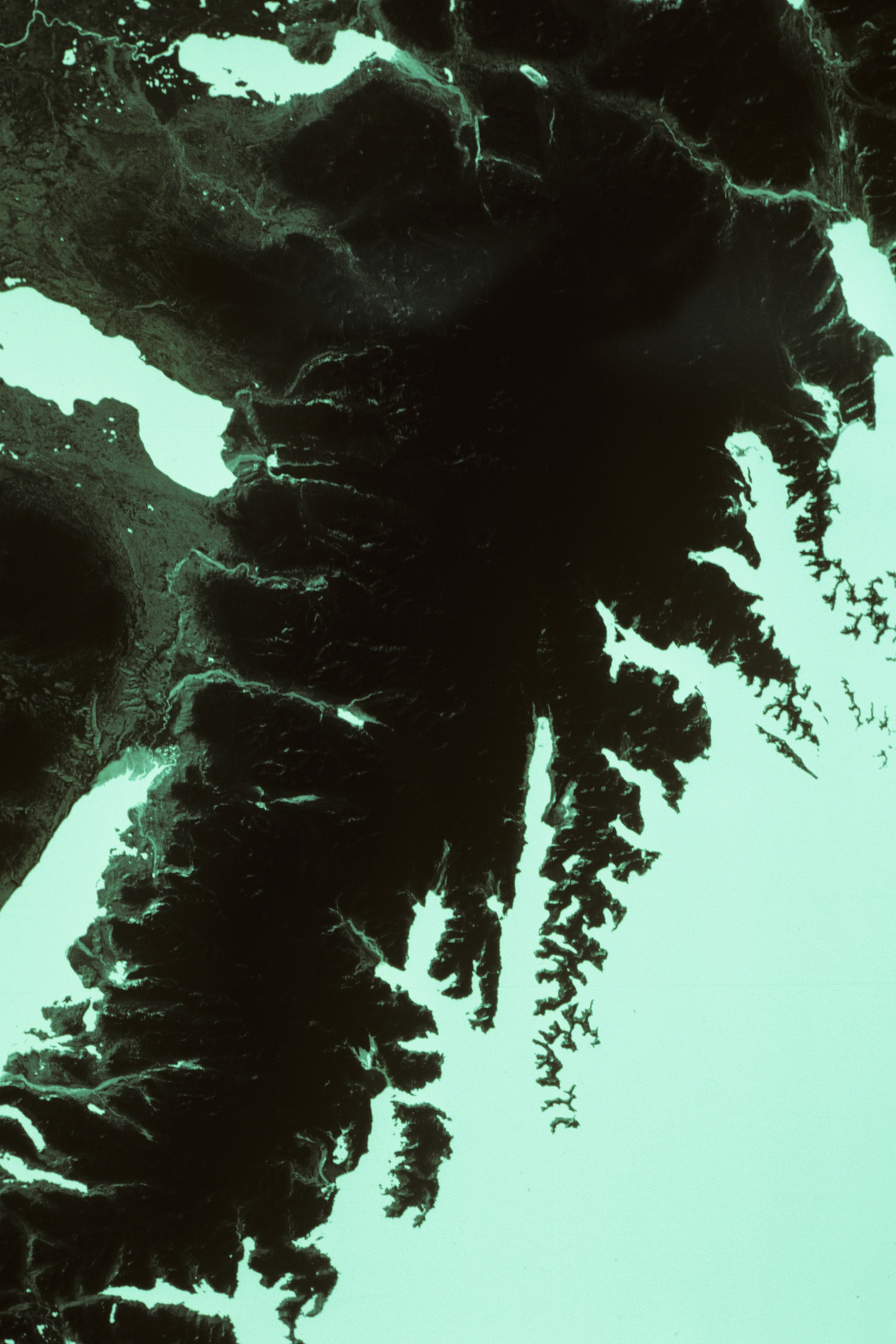
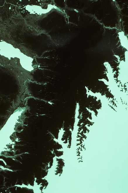
Harding Icefield black and white landsat satellite image negative May 10, 1984
Harding Icefield black and white landsat satellite image negative May 10, 1984
Landsat P68 R18, #50070-20352, MSS7, f11, 1/15 "Negative", May 10, 1984. Bud Rice Photo Collection/NPS
KEFJ-00358 Cat# KEFJ 13829
Slide 10/86-102
1986_10_ERTJ_Hording_Icefield
Slide 018
U.S. National Park Service
Contact the Kenai Fjords National Park for more copyright information and use
Restrictions apply on use and/or reproduction
Image
Kenai Fjords National Park, Code: KEFJ
Kenai Fjords National Park, Kenai Peninsula Borough, Alaska
Latitude: 59.9532012939453, Longitude: -149.88200378418
Latitude: 59.9532012939453, Longitude: -149.88200378418
1984/05/10
Public Can View
Organization: Kenai Fjords National Park
Address: Kenai Fjords National Park, P.O. Box 1727, Seward, AK 99664
Address: Kenai Fjords National Park, P.O. Box 1727, Seward, AK 99664
Monday, March 24, 2025 4:19:36 PM
Monday, March 24, 2025 4:19:36 PM
KEFJ_1986_Rice_ERTS_72-84_Slides_010.jpg
jpg
11.7 MB
Historic