Select Item below to DOWNLOAD - Once item is selected, right click and choose 'save as'
7a05d767-a097-4a83-8108-6802b81a35eb
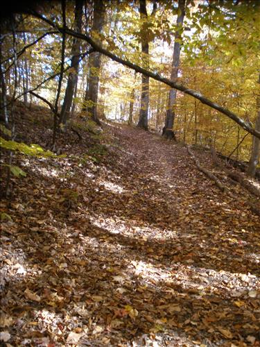
Ft. Circle Trails Stabilization and Maintenance, March 2011
Stabilization and Maintenance of the Ft. Circle Trails, caused by weather deterioration, visitor use and maintenance backlog
Ft. Circle Hiker Biker Trail erosion
Permission must be secured from the individual copyright owners to reproduce any copyrighted materials contained within this website. Digital assets without any copyright restrictions are public domain.
Public domain
Image
National Capital Parks-East, Code: NACE
Ft Circle ; Ft Dupont, District of Columbia , District of Columbia
Latitude: 38.9041481018066, Longitude: -77.0170974731445
Latitude: 38.9041481018066, Longitude: -77.0170974731445
11/13/2010
03/23/2011
Public Can View
Wednesday, March 23, 2011 12:55:42 PM
Thursday, August 10, 2017 12:10:42 AM
NACE-644ee34b51fc4557b6003f4e6af54036.jpg
OLYMPUS IMAGING CORP. OLYMPUS IMAGING CORP., FE370,X880,C575
10/300 sec at f / 3.5
6.3 mm
ISO 125
Saturday, November 13, 2010 8:20:58 PM
jpg
5.1 MB
Inventory
,
Budget