Select Item below to DOWNLOAD - Once item is selected, right click and choose 'save as'
7999d623-6356-49ce-86bd-e0f6d5fbdd3f
Paleogeography
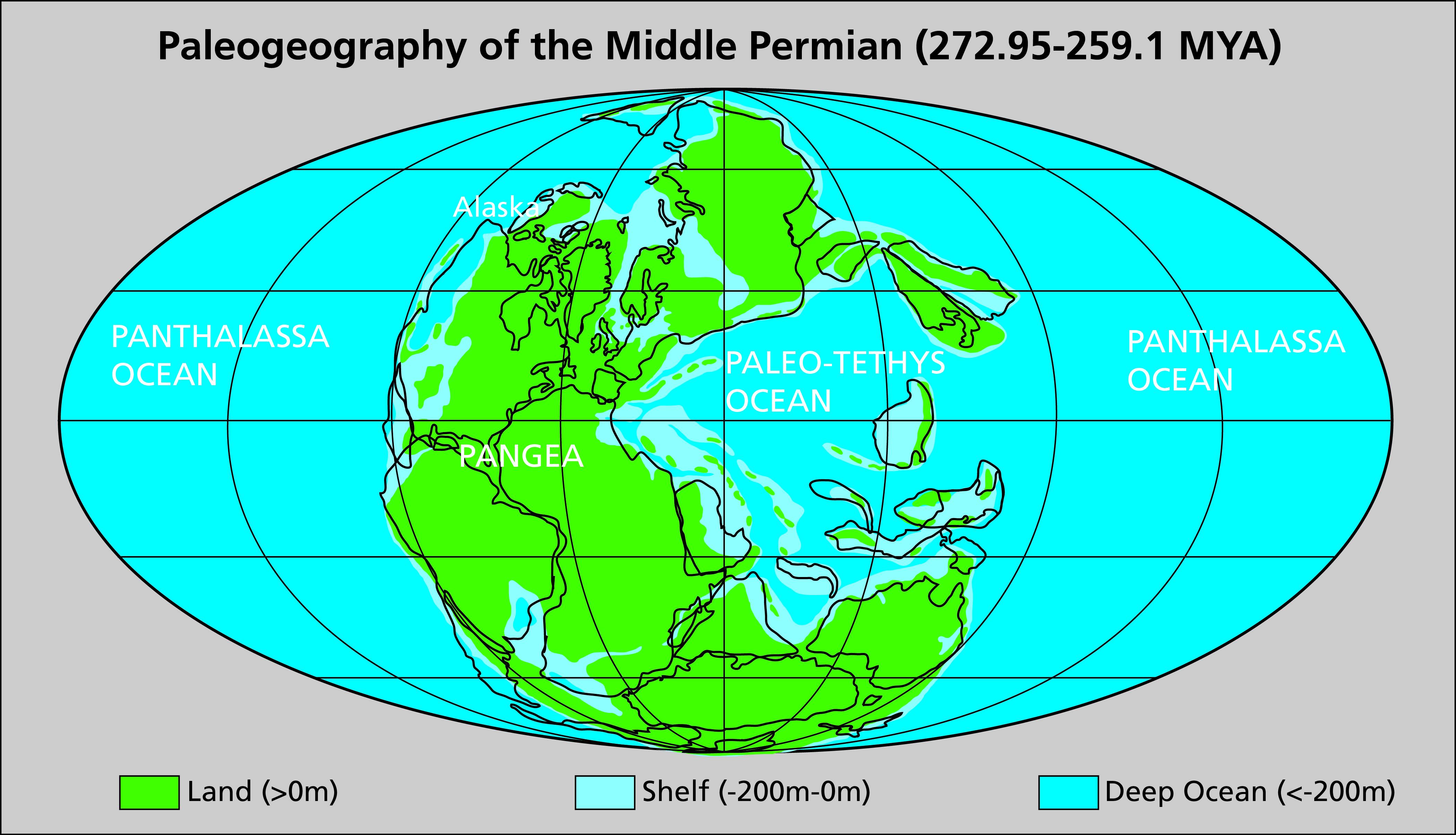
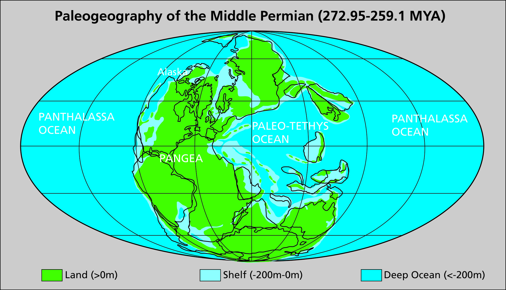
Map showing the paleogeography of the Middle Permian (272.95-259.1 MYA). Three settings are mapped: land (>0m elevation), shelf (-200m–0m), and deep ocean (<-200 m). Shelf areas ring the land. On the map the supercontinent Pangaea forms a “C” shaped landmass centered more or less on the equator. The ocean surrounded on three sides by the “C” of Pangaea is the Paleo-Tethys Ocean.
. Map showing the paleogeography of the Middle Permian (272.95-259.1 MYA). The fossils from the McHugh
Complex limestone are more similar to deposits that formed in and around the Paleo-Tethys Ocean (seen in the center
of the figure). This suggests that the rocks those fossils are found in were formed near the Paleo-Tethys Ocean, and
subsequently transported across the Panthalassa Ocean to Alaska by the movement of the oceanic plate.
Permission must be secured from the individual copyright owners to reproduce any copyrighted materials contained within this website. Digital assets without any copyright restrictions are public domain.
Map by
Amanda Lanik (NPS Alaska Regional Office) using information from Hein (2004).
Public domain:Full Granting Rights
Image
Kenai Fjords National Park, Code: KEFJ
Kenai Fjords National Park, Kenai Peninsula Borough, Alaska
Latitude: 59.9532012939453, Longitude: -149.88200378418
Latitude: 59.9532012939453, Longitude: -149.88200378418
01/01/0001
Public Can View
Monday, August 16, 2021 2:00:08 PM
Monday, August 16, 2021 4:00:37 PM
Fig_55_Permian_Global_Paleogeography_KEFJ.jpg
Monday, January 1, 0001 12:00:00 AM
jpg
4.1 MB
Scenic