Select Item below to DOWNLOAD - Once item is selected, right click and choose 'save as'
77ab3028-96a1-4672-912c-511fb6e5938c
Aug 03 2023 York Fire CLosures Cima Rd Closed-01.png
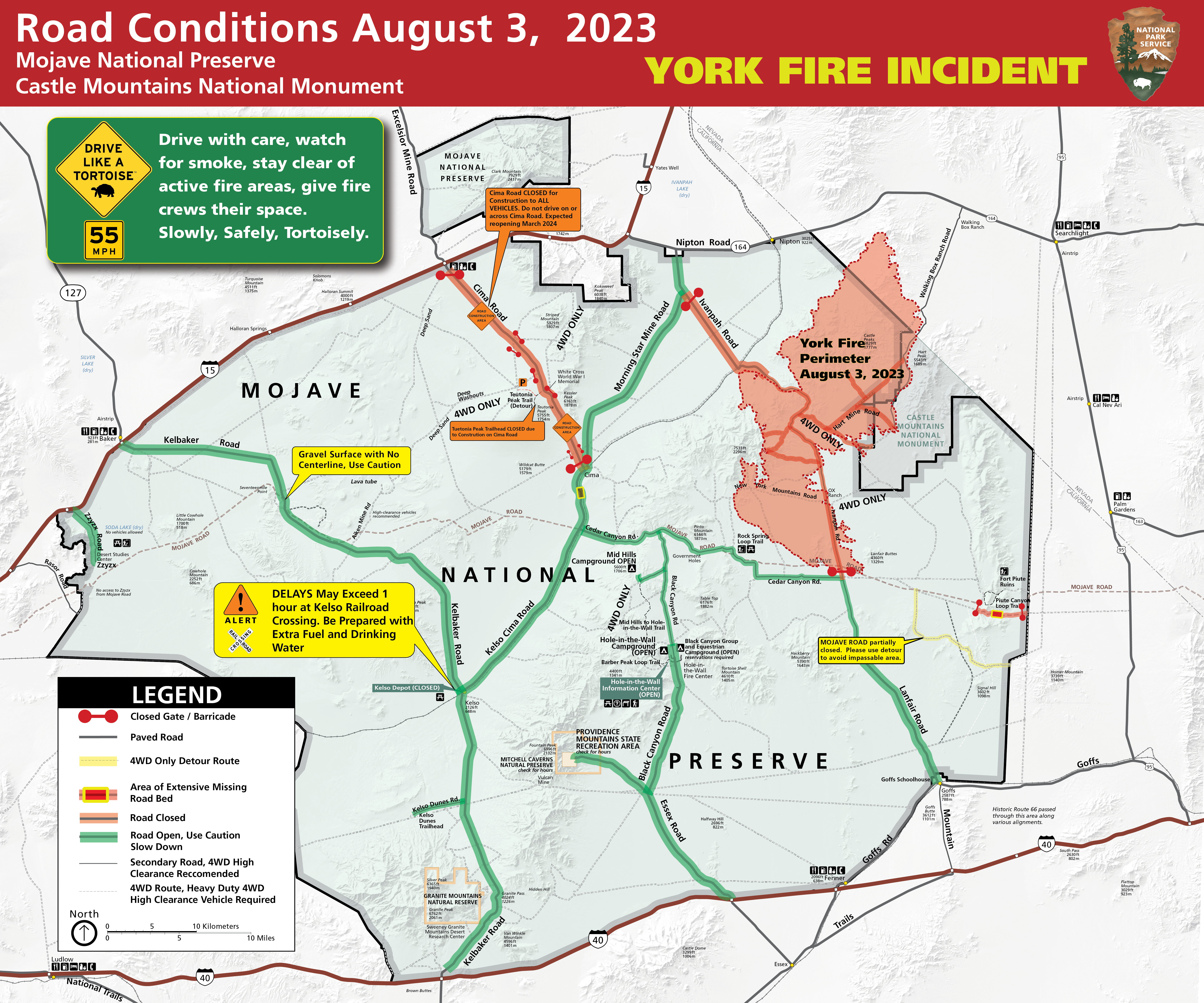
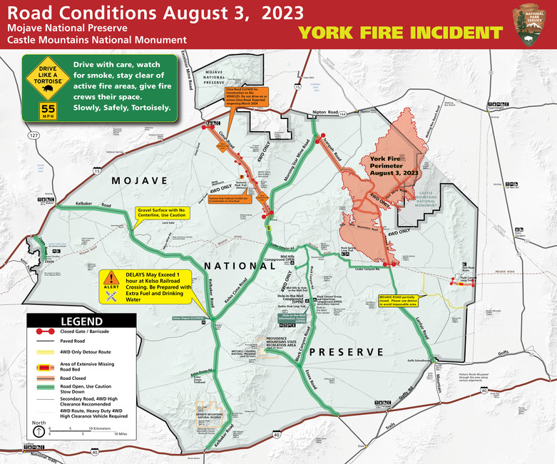
August 3, 2023 Road conditions Map of Mojave National Preserve, showing red closed roads at Cima Road and Ivanpah Road between Monring Star Mine and Cedar Canyon Roads. York FIre Perimeter shown in approximate location on northeastern section of preserve.
Road Conditions Map for August 3rd, 2023 during the York Fire Incident at Mojave National Preserve and Avi Kwa Ame National Monument.
Permission must be secured from the individual copyright owners to reproduce any copyrighted materials contained within this website. Digital assets without any copyright restrictions are public domain.
NPS
Public domain:Full Granting Rights
Image
Castle Mountains National Monument, Code: CAMO
Mojave National Preserve, Code: MOJA
Mojave National Preserve, Code: MOJA
Castle Mountains National Monument
Mojave National Preserve, San Bernardino County, California
Latitude: 35.114200592041, Longitude: -115.514999389648
Mojave National Preserve, San Bernardino County, California
Latitude: 35.114200592041, Longitude: -115.514999389648
08/03/2023
Public Can View
Thursday, August 3, 2023 4:47:15 PM
Thursday, August 3, 2023 4:49:47 PM
Aug 03 2023 York Fire CLosures Cima Rd Closed-01.png
png
15.0 MB
Scenic