Select Item below to DOWNLOAD - Once item is selected, right click and choose 'save as'
767ca8cd2d444343a0aa4b8745926b82
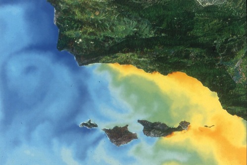
sea temperature map
sea temperature map
U. S. National Park Service
Contact the Channel Islands National Park for more copyright information and use
NOAA
Public domain:Full Granting Rights
Image
Channel Islands National Park, Code: CHIS
Channel Islands National Park, California
Latitude: 34.0039100646973, Longitude: -119.725196838379
Latitude: 34.0039100646973, Longitude: -119.725196838379
5/19/2009
05/19/2009
Extracted from: Final Cut Server database
Public Can View
Person: Program Manager
Organization: Channel Islands National Park
Address: 1901 Spinnaker Drive, Ventura CA 93001
Organization: Channel Islands National Park
Address: 1901 Spinnaker Drive, Ventura CA 93001
Monday, June 29, 2020 5:56:02 PM
Monday, June 29, 2020 5:56:02 PM
sea temperature map.tif
tif
3.3 MB
Scenic