Select Item below to DOWNLOAD - Once item is selected, right click and choose 'save as'
7643d414-34ee-4a87-a884-70de1133a75d
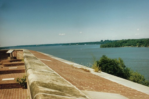
South demi-bastion wall
Photo of the top of the parapet wall, with cannon mounts to the left and the Potomac River to the right showing the Virginia shoreline
The top edge of the parapet wall, facing south showing the Potomac River
Permission must be secured from the individual copyright owners to reproduce any copyrighted materials contained within this website. Digital assets without any copyright restrictions are public domain.
NPS Photo
Public domain:Full Granting Rights
Image
Fort Washington Park, Code: FOWA
Historic Fort, Fort Washington Park, Prince George's County, Maryland
Latitude: 38.7122001647949, Longitude: -77.0287017822266
Latitude: 38.7122001647949, Longitude: -77.0287017822266
01/01/0001
Public Can View
Thursday, April 23, 2020 5:13:20 PM
Thursday, April 23, 2020 5:13:20 PM
scan0028.jpg
Monday, January 1, 0001 12:00:00 AM
jpg
151.4 kB
Scenic