Select Item below to DOWNLOAD - Once item is selected, right click and choose 'save as'
75b702dd-4203-42a8-bb1c-5ad299bb1547
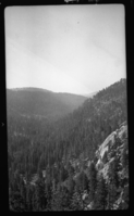
Marble Fork Kaweah River Canyon, Glaciated Canyon, Type Map. 1 1/2 mi NNW of Heather Lake 8700'.
SEKI Historic Image
Marble Fork Kaweah River Canyon, Glaciated Canyon, Type Map. 1 1/2 mi NNW of Heather Lake 8700'.
National Park Service
Akey, 361012, Marble Fork Kaweah River Canyon, SNP, Marble Fork Kaweah River Canyon, Glaciated Canyon, Type Map. 1 1/2 mi NNW of Heather Lake 8700'.
Permission must be secured from the individual copyright owners to reproduce any copyrighted materials contained within this website. Digital assets without any copyright restrictions are public domain.
Public domain
Image
Marble Fork Kaweah River Canyon, Tulare County, California
10/12/1936
option 1
Tuesday, January 10, 2017 12:59:51 PM
Tuesday, January 10, 2017 12:59:51 PM
08252.tif
Monday, January 1, 0001 12:00:00 AM
tif
15.7 MB
Scenic
,
Historic