Select Item below to DOWNLOAD - Once item is selected, right click and choose 'save as'
740b5fe1-6dc2-4ae4-aca0-5544661d19f9
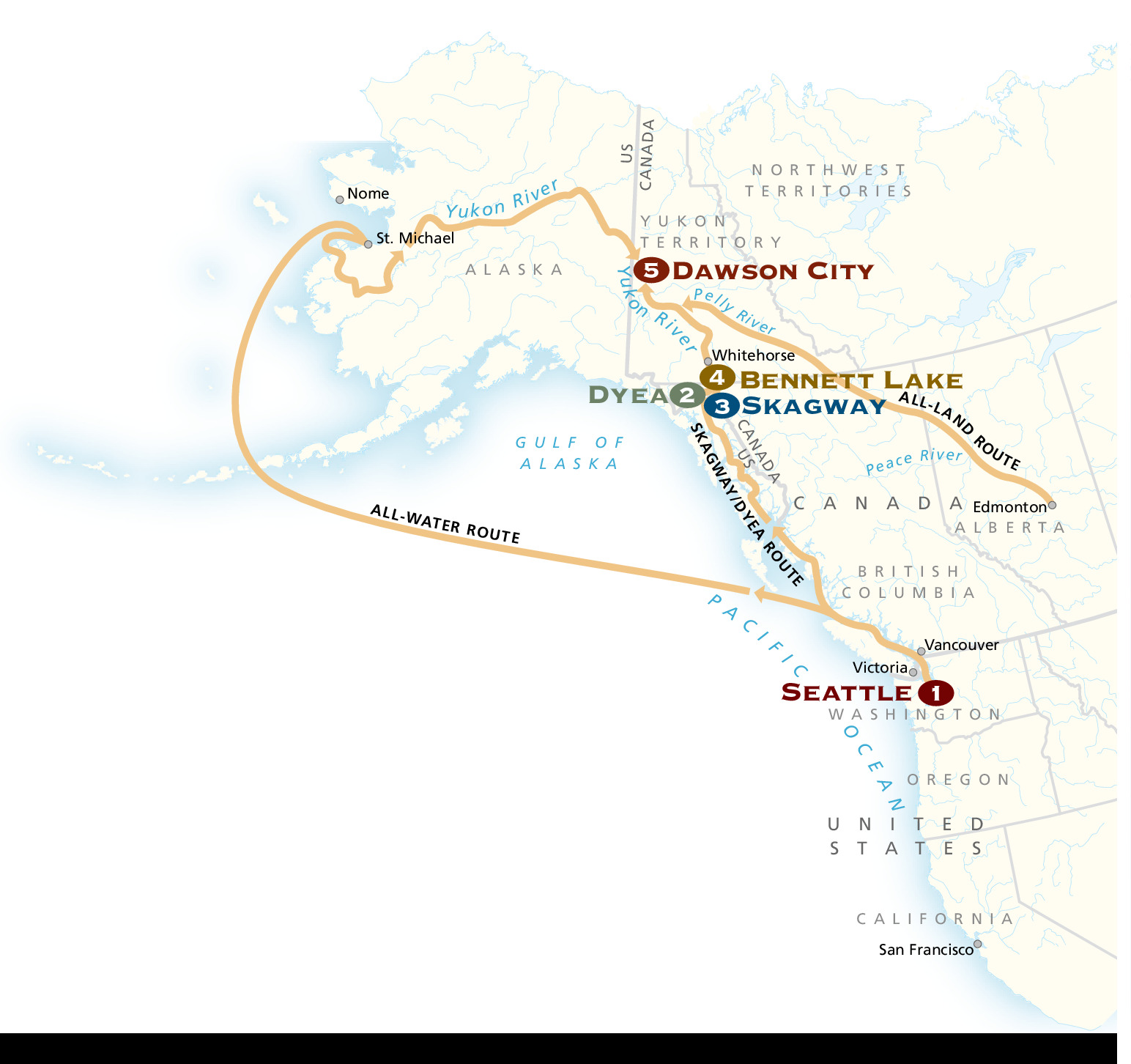
Klondike Gold Rush Routes Map - Klondike Gold Rush National Historical Park
Historical map of gold rush routes around Klondike Gold Rush National Historical Park in Alaska. The west coast of North America is shown in off-white, the coastline shaded blue, and routes shown in dark yellow.
Screen-viewable file; Adobe print production files can be downloaded from the Compressed zip Version link
Map Projection: Other; Map Type: unassigned
U.S. National Park Service
The National Park Service maps are government produced and are in the public domain. Anyone may, without restriction under U.S. copyright laws: Reproduce the work in print or digital form; Create derivative works; Perform the work publicly; Display the work; Distribute copies or digitally transfer the work to the public by sale or other transfer of ownership, or by rental, lease, or lending. Please note, a user who modifies and/or republishes National Park Service maps are responsible for any problems encountered with the maps, due to their change or modification.
Public domain
Document
Klondike Gold Rush National Historical Park, Code: KLGO
Klondike Gold Rush National Historical Park, Skagway Municipality, Alaska
Latitude: 59.6315994262695, Longitude: -135.292999267578
Latitude: 59.6315994262695, Longitude: -135.292999267578
2013-05-09
Public Can View
Person: Harpers Ferry Center
Organization: US National Park Service
Address: Harpers Ferry Center, Harpers Ferry, WV
Email: HFC_Cartography@nps.gov
Organization: US National Park Service
Address: Harpers Ferry Center, Harpers Ferry, WV
Email: HFC_Cartography@nps.gov
Tuesday, April 26, 2022 9:47:17 PM
Friday, September 26, 2025 11:36:13 PM
KLGOmap3.pdf
pdf
760.6 kB
Map