Select Item below to DOWNLOAD - Once item is selected, right click and choose 'save as'
7399df95c178428cba2acc3d33591703
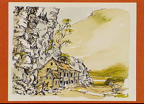
One of three panels showing houses built along cliffs around Harpers Ferry.
One of three panels showing houses built along cliffs around Harpers Ferry.
Illustrated together with IMS #02908 & IMS #02909.; Abbr=AVA
U.S. National Park Service
Reflective Art
Government owns art and all reproduction rights.
Public domain
Pen and ink with watercolor, (HFC ArtMedium)
Image
Harpers Ferry National Historical Park, Code: HAFE
Harpers Ferry National Historical Park
Latitude: 39.312858581543, Longitude: -77.7419586181641
Latitude: 39.312858581543, Longitude: -77.7419586181641
Image Management System : IMS 02910
20190904
Image_Size=W: 20" x H: 15 3/16"; Metric_Size=W: 50.76CM X H: 38.07CM; AVA Project #41, #31, Plate 79
S9
Public Can View
Organization: Harpers Ferry Center
Address: Harpers Ferry Center, 67 Mather Place, Harpers Ferry, WV, 25425, 304-535-5050
Address: Harpers Ferry Center, 67 Mather Place, Harpers Ferry, WV, 25425, 304-535-5050
Thursday, October 3, 2019 5:31:40 PM
Thursday, October 3, 2019 5:31:40 PM
02910.JPG
jpg
134.4 kB
Museum