Select Item below to DOWNLOAD - Once item is selected, right click and choose 'save as'
738d6c36-f478-4dc2-8810-ab7e8163c47b
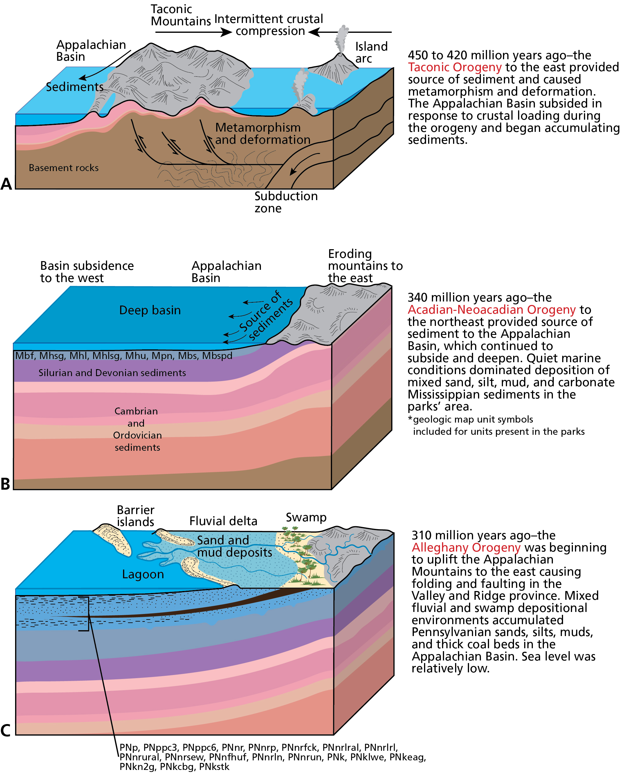
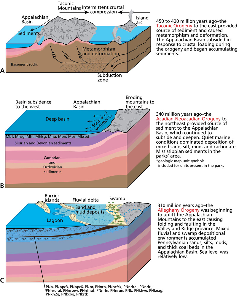
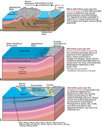
Landscape and Geologic Evolution
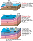
Schematic graphics illustrating the evolution of the landscape and geologic foundation of Bluestone NSR, Gauley River NRA, and New River Gorge NR from about 450 to 310 million years ago. Graphic includes 3 block diagrams.
Illustration of the evolution of the landscape and geologic foundation of Bluestone NSR, Gauley River NRA, and New River Gorge NR. Continued on next page. Graphics are not to scale. Colors are standard colors approved
by the US Geological Survey to indicate different time periods on geologic maps, and correspond to the colors on the
figures in this report. Map symbols are included for the geologic units mapped within the parks.
Permission must be secured from the individual copyright owners to reproduce any copyrighted materials contained within this website. Digital assets without any copyright restrictions are public domain.
Graphic by Trista L.
Thornberry-Ehrlich (Colorado State University).
Public domain:Full Granting Rights
Image
Bluestone National Scenic River, Code: BLUE
Gauley River National Recreation Area, Code: GARI
New River Gorge National Park and Preserve, Code: NERI
Gauley River National Recreation Area, Code: GARI
New River Gorge National Park and Preserve, Code: NERI
Bluestone National Scenic River, West Virginia
Latitude: 37.5690498352051, Longitude: -80.983757019043
Gauley River National Recreation Area, West Virginia
Latitude: 38.2069396972656, Longitude: -81.0023803710938
New River Gorge National Park and Preserve, West Virginia
Latitude: 37.840259552002, Longitude: -80.9897079467773
Latitude: 37.5690498352051, Longitude: -80.983757019043
Gauley River National Recreation Area, West Virginia
Latitude: 38.2069396972656, Longitude: -81.0023803710938
New River Gorge National Park and Preserve, West Virginia
Latitude: 37.840259552002, Longitude: -80.9897079467773
01/01/0001
Public Can View
Thursday, August 5, 2021 1:15:50 PM
Thursday, August 5, 2021 2:53:23 PM
05_BLUE-GARI-NERI_geol_evolution_0919-2017_tte-01.jpg
Monday, January 1, 0001 12:00:00 AM
jpg
1.7 MB
Scenic