Select Item below to DOWNLOAD - Once item is selected, right click and choose 'save as'
73844b37-3131-4e31-b281-86e91dab1c8f
THRO_paleontology_inventory_2022_fig 51.jpg
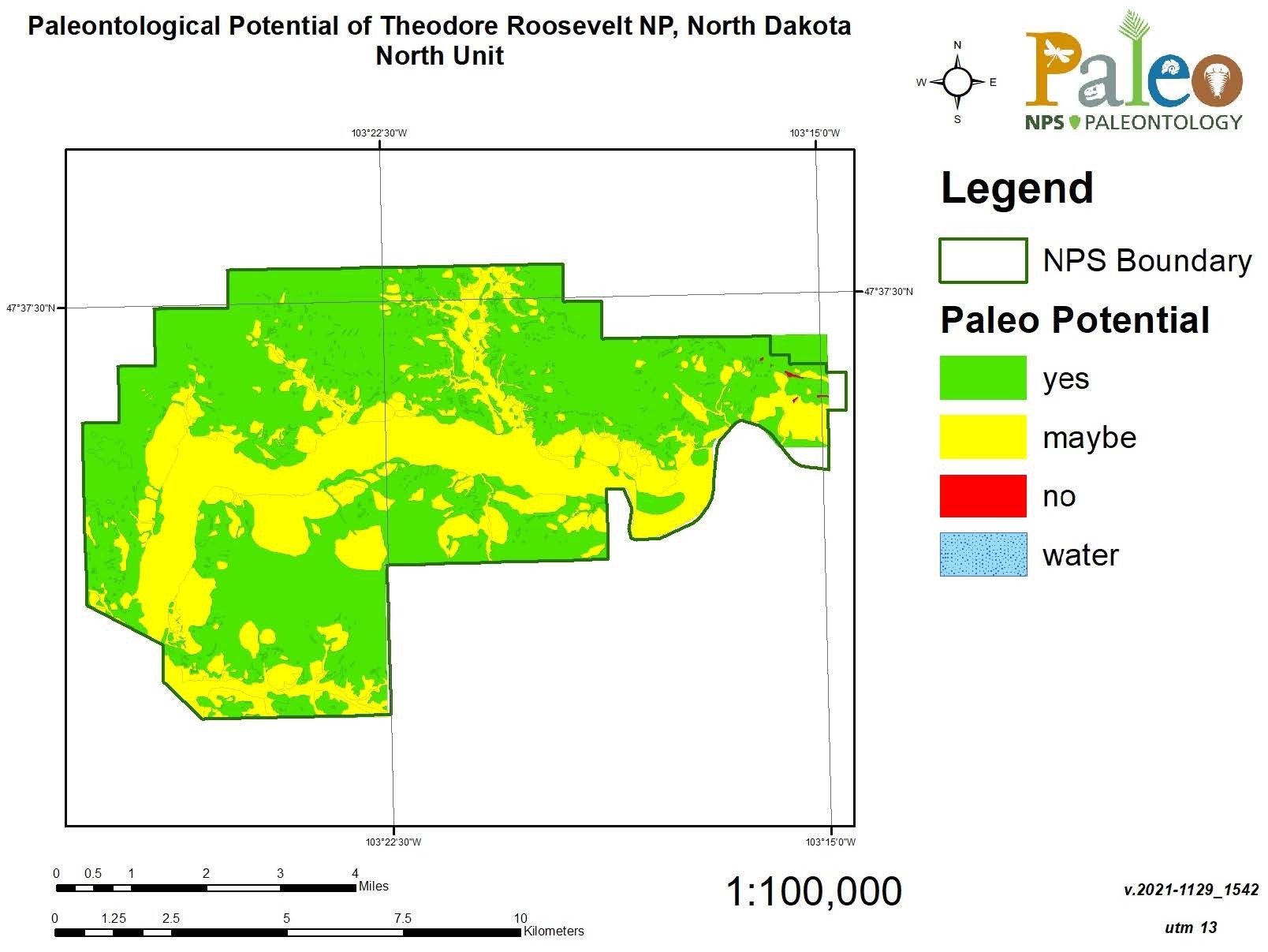
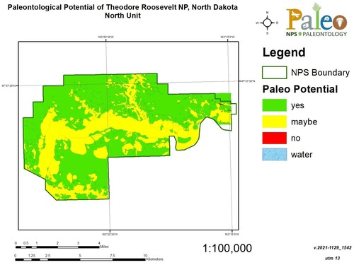
Figure 51. A map of the North Unit of Theodore Roosevelt National Park with paleontological potential indicated by colors. Green indicates a geologic unit that has produced fossils in the park. Yellow units have not yet produced fossils in the park, but might. Red units have not produced fossils and are unlikely to do so (igneous and high-grade metamorphic rocks, etc.). Most of the map is green.
Figure 51. Map indicating paleontological potential of geologic map units in the North Unit of THRO. The Bullion Creek and Sentinel Butte Formations have yielded fossils within THRO. Quaternary deposits within THRO are potentially fossiliferous.
Permission must be secured from the individual copyright owners to reproduce any copyrighted materials contained within this website. Digital assets without any copyright restrictions are public domain.
NPS map compiled by Tim Connors.
Public domain:Full Granting Rights
Image
Theodore Roosevelt National Park, Code: THRO
Geologic Resources Division, Code: GRD
Geologic Resources Division, Code: GRD
Theodore Roosevelt National Park, North Dakota
Latitude: 46.9522094726563, Longitude: -103.459701538086
Latitude: 46.9522094726563, Longitude: -103.459701538086
04/26/2024
01/01/0001
Public Can View
Friday, April 26, 2024 6:03:23 PM
Friday, April 26, 2024 6:21:51 PM
THRO_paleontology_inventory_2022_fig 51.jpg
Monday, January 1, 0001 12:00:00 AM
jpg
132.2 kB
Scenic