Select Item below to DOWNLOAD - Once item is selected, right click and choose 'save as'
727a46d8-8e71-4e48-9807-4e4acd93c7c6
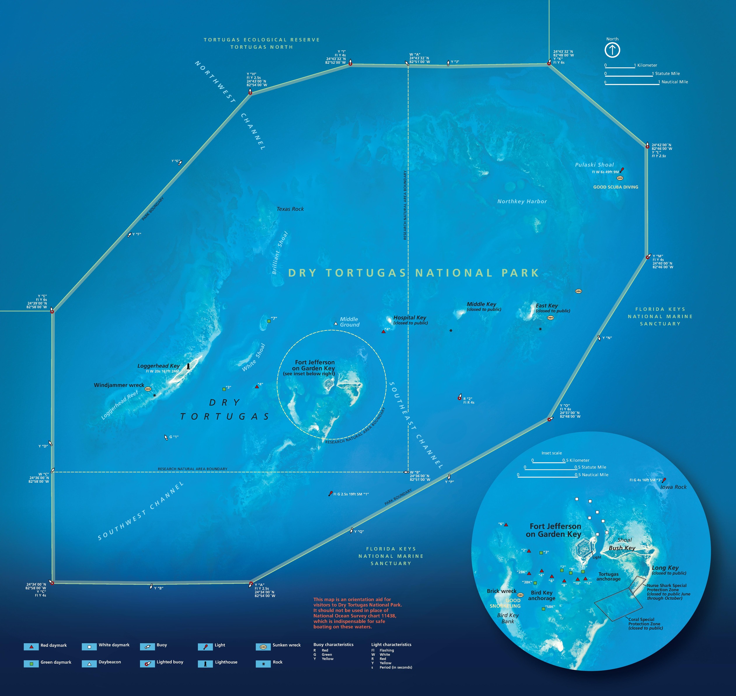
Park Map - Dry Tortugas National Park
Map of Dry Tortugas National Park in Florida. The base layer of the map is mostly open water rendered in shades of blue, with some lighter coloration for the small islands and coral reefs scattered throughout the park.
Screen-viewable file; Adobe print production files can be downloaded from the Compressed zip Version link
Map Projection: UTM; Map Type: park map
U.S. National Park Service
The National Park Service maps are government produced and are in the public domain. Anyone may, without restriction under U.S. copyright laws: Reproduce the work in print or digital form; Create derivative works; Perform the work publicly; Display the work; Distribute copies or digitally transfer the work to the public by sale or other transfer of ownership, or by rental, lease, or lending. Please note, a user who modifies and/or republishes National Park Service maps are responsible for any problems encountered with the maps, due to their change or modification.
Public domain
Document
Dry Tortugas National Park, Code: DRTO
Dry Tortugas National Park, Monroe County, Florida
Latitude: 24.6525993347168, Longitude: -82.8694000244141
Latitude: 24.6525993347168, Longitude: -82.8694000244141
2018-06-18
Public Can View
Person: Harpers Ferry Center
Organization: US National Park Service
Address: Harpers Ferry Center, Harpers Ferry, WV
Email: HFC_Cartography@nps.gov
Organization: US National Park Service
Address: Harpers Ferry Center, Harpers Ferry, WV
Email: HFC_Cartography@nps.gov
Tuesday, April 26, 2022 1:25:51 PM
Friday, September 26, 2025 11:34:55 PM
DRTOrelief1.pdf
pdf
38.1 MB
Map